Mapping archaeological sites in Oslo

Being an archaeologist often means digging and finding artefacts. But a lot of work is also done from behind one’s desk. I work with heritage protection at the National Trust of Norway, mostly with buildings from the 18th century onwards. The trust applies for funding for different projects, one of those projects was creating a map of historic buildings in an area of Oslo, Norway, with the support of a trust called Sparebankstiftelsen DNB. The aim of the project was to make local heritage accessible to everyone. The project resulted in an online map, a folder, and a guided tour of the area.

There was still money left after the project was finished, and last year we decided to also map archaeological finds and old farms in the area. The oldest buldings that were registered in the previous map were built the 17th century, so we decided to map finds and place-names from the Stone Age up until the medieval period (10,000 BC – AD 1537).

To start the research, I checked the Norwegian heritage databases. Norway has two heritage databases where most finds, sites and buildings in Norway are registrered: Askeladden is for heritage professionals and requires a log in, while Kulturminnesøk is open to everyone. I also visited the archives at the Museum of Cultural History, they have documents concerning archaeological finds. Many of the finds were found in the 19th century, and this information is not always available online. I also read reports from the Agency for Heritage Management in Oslo, they are responsible for archaeological registration projects in Oslo. A lot of books and articles about Oslo’s prehistory were also consulted. Finally, I checked references to old farm-names. Some of the farm names still exist, but we cannot know that they were in the same location.

After making a list of the finds, I visited the Museum of Cultural History again. Most of the artefacts are stored there, and it is possible to look at the artefacts and take pictures. In the end, a total of 49 archaeological finds and old farms were chosen to be included in the map. I then had to rewrite the information I had gathered to make them presentable online. Following are some snippets from the exciting finds:

The heritage map. Stone Age finds (green), Iron Age finds (blue), medieval structures (orange), farms from the Iron Age (red). Illustration: Anne Grandt, The National Trust of Norway.

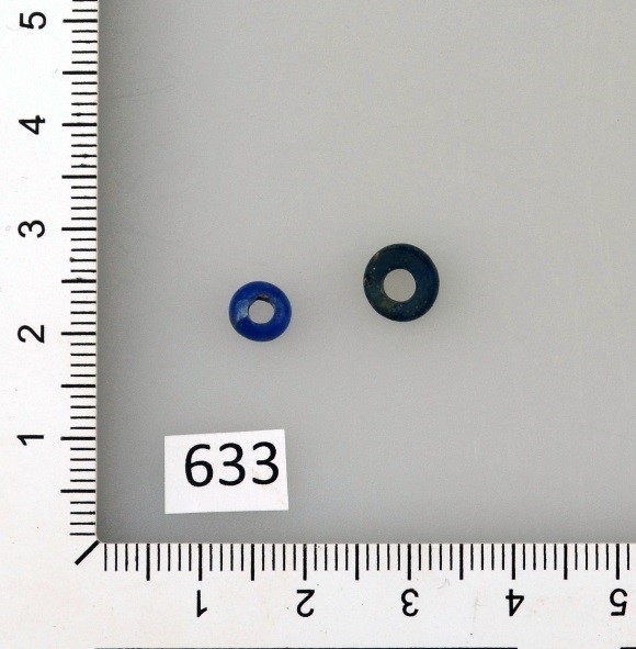
The earliest finds are from around 5000 BC, the later part of the Norwegian Early Stone Age, before agriculture was introduced. These finds are from an archaeological culture called the Nøstvet-culture. One is an axe that was found alone, while a big settlement was found where one of the major roads through town is located today. The remaining Stone Age finds are from the Later Stone Age (4000-1800 BC), mostly axes. There are no Bronze Age artefacts on the map, but some archaeological structures discovered by the Agency for Heritage Management have been dated to the Bronze Age (1800-500 BC).

Axes from the Later Stone Age (4000-1800 BC) found in Oslo. Photo: Linn Marie Krogsrud, courtesy of the Museum of Cultural History.

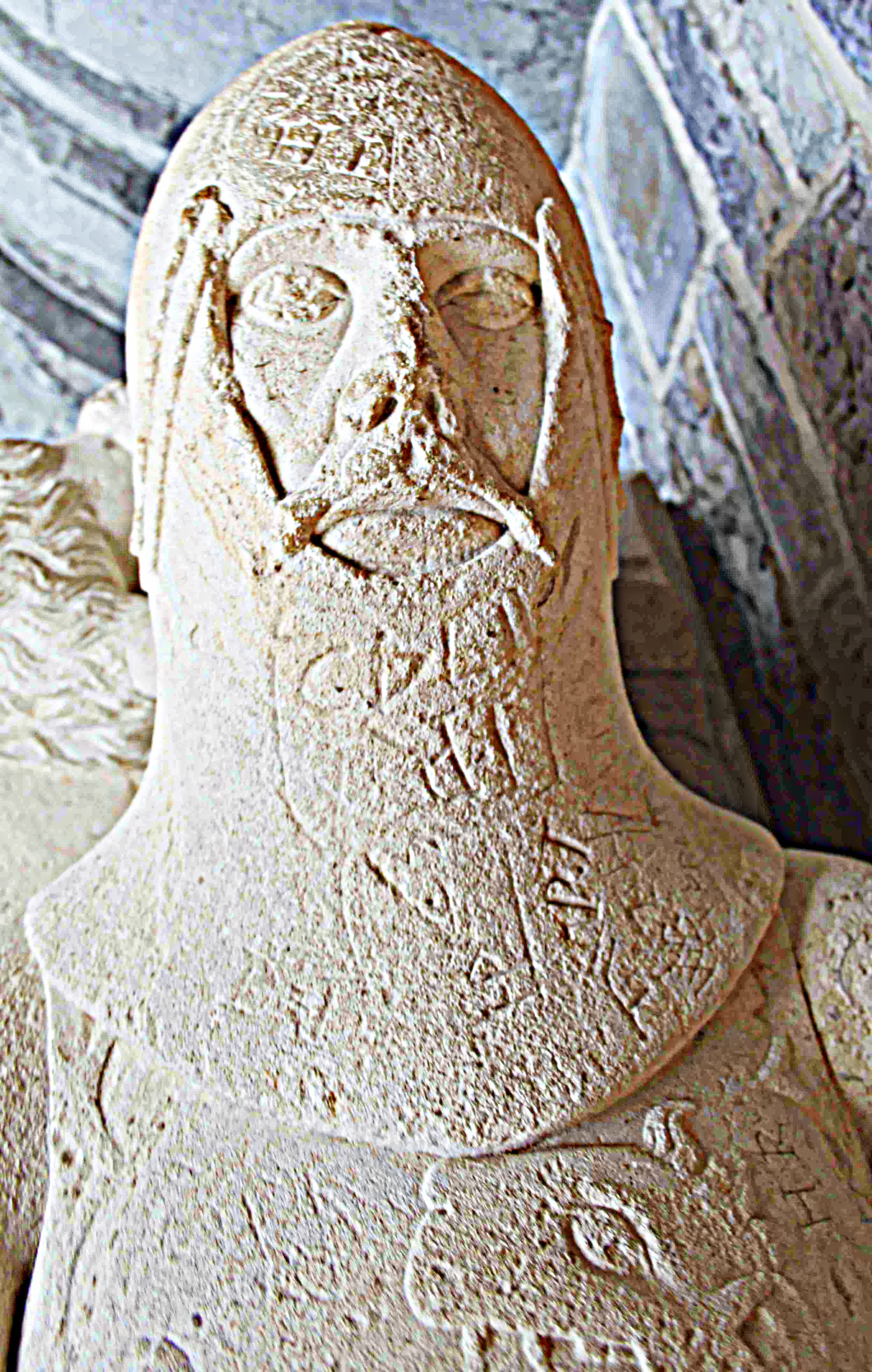
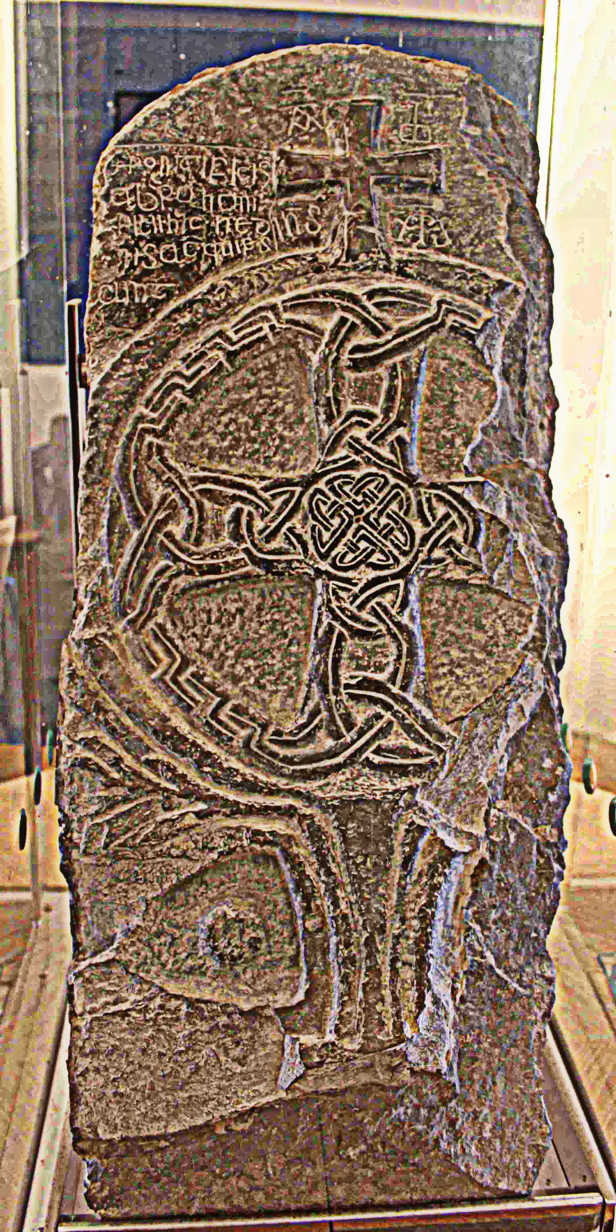
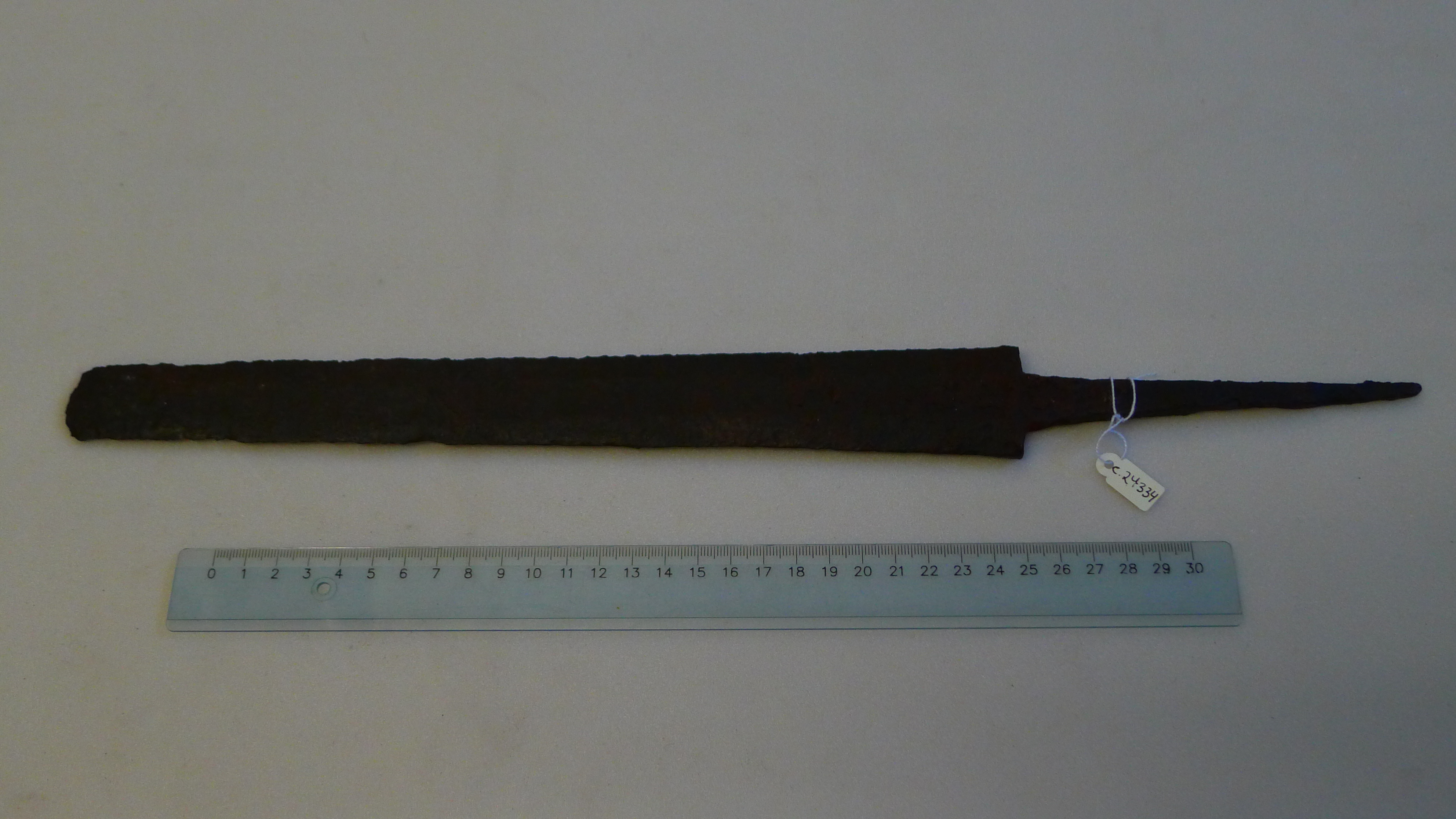
The majority of the archeological finds can be dated to the Iron Age (500 BC – AD 1050), more specifically the Viking Age (AD 800-1050). It is evident that the area was important and relatively densely populated in this period. Most of the finds are artefacts from graves, such as swords, axes and spear heads. Some burial mounds are still preserved, but they have not been excavated.

Artefacts from a Viking Age burial (AD 800-1050) found in Oslo. Photo: Linn Marie Krogsrud, courtesy of the Museum of Cultural History.

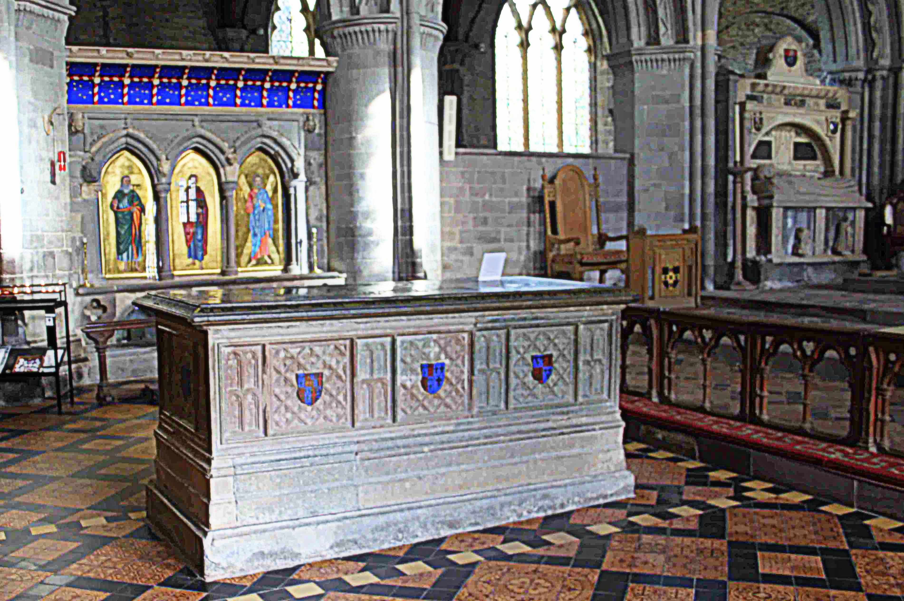
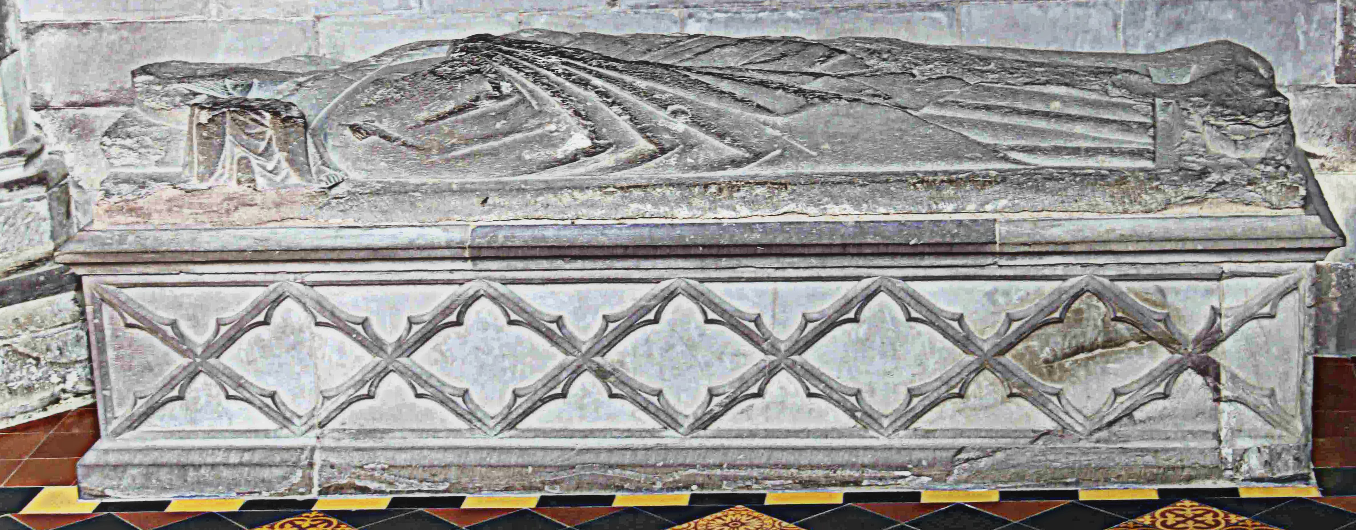
There are also structures that were constructed in the medieval period (AD 1050-1537). One of the structures is a church from the early 12th century that still stands. An old mine still exists beneath the church, the mine was probably exploited already in the 12th century. Two roads still in existence can be dated to the medieval period, but we cannot be sure that they followed the exact same route as today. They are both mentioned in historical records.

Iron sword from the Roman period (AD 0-400) found in Oslo. Photo: Linn Marie Krogsrud, courtesy of the Museum of Cultural History.

The remaining sites that were researched were 14 old farms. We know that they were in existence in the Iron Age, as we can date the names. Historical records from the medieval period mention the farms, so we know that many of them survived. Some of them exist even today, but it is possible that they were moved several times during their long history. Some of the farms are long gone, and only their names attest to their existence. Interestingly, many of the Iron Age artefacts have been found near were some of the farms are located today.

The aim of the project was to map the history of a part of Oslo. We want people to explore the area on their own, and both maps are available from our office and online.

www.fortidsminneforeningen.no/oa/kulturminnekart/eldre-tids-kulturminner (In Norwegian).

Linn Marie Krogsrud is a Norwegian archaeologist, she works for the National Trust of Norway.

What Archaeological Features can tell us about the Past

When people hear that I am an archaeologist they usually want to know if I have ever found anything interesting on an excavation. I usually tell them about the blue glass beads which I found on our excavation at Meillionydd, near Rhiw on the Llŷn peninsula in Northwest Wales (UK). To me these beads are special because they were hard to spot – tiny and covered in soil as they were. However, from an archaeological viewpoint those beads are hardly something to be excited about. They do not tell us much about the site or the people who once lived there.

One of the glass beads found at Meillionydd in 2014 in situ.

What is much more interesting to me as an archaeologist are the features that we excavate. Meillionydd is a double ringwork enclosure, a settlement that at some point during its existence was surrounded by two banks. If you are on site today – outside of our excavation season – you will hardly notice the remains of the banks, because they were slighted at some point.

The glass beads from Meillionydd in their cleaned state.

However, underneath a few centimetres of grass and soil there remains plenty of archaeological evidence. Thanks to our excavations and a Ground Penetrating Radar (GPR) survey, which was carried out by the ZAMG in 2012, we know that the site started out as an unenclosed settlement consisting of timber roundhouses. The settlement was surrounded by a ditch and a wooden palisade at a later stage, until both of these features were replaced by two earth and stone banks. At roughly the same time, the timber roundhouses were replaced by stone built roundhouses. The GPR interpretation shows that there were around 100 roundhouses on site. We do know that these houses were not built all at once, because they intersect with each other and, therefore, cannot have existed at the same time.

Interpretation of the 2012 GPR survey highlighting the ditch (brown) and - where possible - different types of roundhouses (blue = unspecified roundhouse, yellow = timber roundhouse & green = stone roundhouse) potentially present on site. Furthermore, it includes Trenches 1, 2 and 3 in different stages of excavation.
Interpretation of the 2012 GPR survey highlighting the ditch (brown) and – where possible – different types of roundhouses (blue = unspecified roundhouse, yellow = timber roundhouse & green = stone roundhouse) potentially present on site. Furthermore, it includes Trenches 1, 2 and 3 in different stages of excavation.


Archaeologists usually use pottery or other finds to date sites or specific features on sites. Unfortunately, people in Wales stopped using pottery during the Late Bronze Age and only started using it again after the Roman invasion in the first century AD. In fact, at Meillionydd we find hardly any finds except for stone tools, which are chronologically unspecific and thus cannot be used for dating the site. In the absence of finds, the only absolute dating method that we can use is radiocarbon dating. For this purpose we collect charcoal samples. The two samples that we had analysed as of yet give us a range of 500 years, from the 8th to the 3rd century BC, during which the site was in use. We are planning to use this method to date most features on site.


Where we do not find charcoal, the only method we can use to date features is stratigraphy. While this method does not give us actual dates for features, it does tell us if features are older or younger than others. When you use the stratigraphic method you look at how features overlap and/or intersect with each other. For example, at Meillionydd we found the remains of a roundhouse next to the entrance through the outer bank. When we first started to excavate this feature in 2012 it looked like the roundhouse was cut into the outer bank. It seemed likely that it was built at a later stage than the bank and that part of the bank had been cut away to build the roundhouse.

Plan of the 2010 to 2015 excavations at Meillionydd. Banks indicated in grey, roundhouses as coloured circles. Roundhouse with drainage gully at the end of the southern terminal of the outer bank highlighted by red square.


However, when excavating the entrance through the outer bank in 2014 we realised that the drainage gully of the roundhouse runs underneath the bank. For the gully to be underneath the bank it must have been dug before the bank was build. Therefore, the gully and the roundhouse must have been built before the bank was built. Combined with other evidence it seems likely that both the roundhouse and the bank were built roughly at the same time and that the roundhouse functioned as a gate house.

This example explains how archaeological features give insights into the past and why an undisturbed, well documented stratigraphy is important. At this point, most of the dating at Meillionydd has been done through stratigraphy. Without this method we would not have been able to say how the settlement developed. The undisturbed stratigraphy on site enables us to gain valuable information that might be lost otherwise.

For more information on the Meillionydd excavations, please visit the website (http://meillionydd.bangor.ac.uk/) or follow us on Facebook (https://www.facebook.com/meillionydddig/) and Twitter (https://twitter.com/Meillionydddig).

Katharina Möller is a German archaeologist with an interest in Public and Community archaeology. She is an Honorary Research Associate and a PhD student at the School of History and Archaeology at Bangor University (UK). Since 2013 she co-directs the excavations at Meillionydd together with her colleague Raimund Karl.

A Heritage Walk for Hearing Impaired Children

GoUNESCO Make Heritage Fun – Calcutta, March 2017

INTRODUCTION
On 27th March 2017, Heritage Walk Calcutta, in collaboration with Made in Bengal and ArchaeologistsEngage, hosted the year’s first GoUNESCO Make Heritage Fun event in Kolkata, India. Make Heritage Fun is a global initiative by GoUNESCO, aimed at celebrating local culture—simultaneously, across the world. This campaign provides a platform for heritage and culture enthusiasts to share local heritage with others in their community. In Calcutta, we organized an event to help children with hearing-related disabilities explore Calcutta’s history through a guided and assisted 2-hour walking tour inside the compound of St. John’s Church, one of the oldest in the city. For this event, we were proud to work with the Ideal School for the Deaf, located in Salt Lake, Kolkata. 26 of their students from 6th to 10th grade (12-17 years old) and 6 teachers actively participated in this event. The tour was led by Tathagata Neogi, an archaeologist and the co-founder of Heritage Walk Calcutta, and translated into sign language by the accompanying teachers.

DSC01106

After the walking tour, we asked the children to create a work of art about what they learned during the walk.  When ready, these paintings/sketches will be shared through our online platforms and displayed during an exhibition at the Ideal School for the Deaf later this year.

The following is a link to the live telecast at the beginning of the walk.
https://www.facebook.com/heritagewalkcal/videos/1473483729360771/

VISION
The accessibility of historic sites is an issue that has not been widely addressed globally. While some countries have recently passed legislation to ensure the accessibility of major historic sites for various groups with disabilities, this issue has not been systematically addressed in India, despite the country’s rich tangible and intangible heritage, and large population of people with disabilities. By conducting a heritage walk specifically aimed at children with hearing-related disabilities under the GoUNESCO Make Heritage Fun umbrella, we at Heritage Walk Calcutta wanted to start a discussion about the issue of accessibility in India’s historic sites. Heritage Walk Calcutta and our collaborators believe in a common, shared heritage, which members of disabled communities have an equal right to access.

DSC01119DSC01137PREPARATION
Heritage Walk Calcutta approached GoUNESCO about hosting this event under the Make Heritage Fun umbrella at the end of February. The original plan was to provide a bus tour of several major heritage sites for school children. When GoUNESCO approved our application to host an event, this idea was further refined in the hope of addressing accessibility issues in Indian heritage sites. At this time, our collaborators, Made in Bengal and ArchaeologistsEngage, came on board to provide support for the event. The idea of a bus tour was abandoned in favour of a walking tour to increase the experiential value of the event, and to give ample time for the children to connect with a single historic site in a deeper way.

The St. John’s Church complex was chosen as the venue because of its central location and historical importance as the first Anglican Cathedral of Calcutta. The church compound also houses the graves of Job Charnock, the “founder” of the city, and some other important East India Company personalities from the city’s very early days. The Church complex is also a protected site under the Archaeological Survey of India, which is a perfect setting to start discussions about the accessibility of heritage sites, and which does not have any restrictions on entry. Finally, since the children have hearing-related disabilities, the church compound provided safety from the fast moving traffic on some busiest streets in Kolkata, just outside the walls.

DSC01224

After this plan was finalized, we approached the Ideal School for the Deaf through a common friend. Their authorities were very enthusiastic about the event. We discussed our plan with the head of the institute and other faculty members to come up with an accessible narrative for the children. The school requested that the event be done on Monday, March 27th, rather than on Sunday, which was the day of the international event. GoUNESCO very kindly agreed to let us host the event on this alternate day to make it easier for the children to attend, since many of them come from very far distances to attend the school. The Friday before the event, Tathagata made a presentation at the school to give the children some historical context through pictures and paintings, with translation into sign language. This also provided us, the students, and the teachers with a warm-up run for the event.

DSC01243

To ensure the accessibility of the information during the walking tour, we prepared visual aids for the children. This included print outs of important names, dates and numbers in large fonts and visible colours. Tathagata also spoke slowly in Bangla so that the children, who are experts in lip-reading, could get some information immediately, without waiting for the translation. Both Tathagata and the teacher who was interpreting stood on higher ground whenever possible throughout the tour so that all of the children could easily see them. A small welcome kit was also provided for the children and their teachers, which included a bottle of water and some snacks.

Group

FUTURE DIRECTIONS
The issue of the accessibility of historic sites is very close to our hearts at Heritage Walk Calcutta. We believe that, while one-off events like these can spark a discussion, this talk will die out if it is not regularly followed up by similar events and workshops. Heritage Walk Calcutta is therefore committed to making significant contributions to this discussion by organizing follow-up events for various disabled groups and by working with different stakeholders to make heritage sites more accessible for disabled communities.

Heritage Walk Calcutta is an academic-run company in Kolkata that aims to increase awareness of heritage in the community by connecting scholars and the common people through walking tours and workshops.

Tathagata Neogi is an archaeologist and the co-founder of Heritage Walk Calcutta.

OUR COLLABORATORS
The event would not be possible without the active support of our various collaborators and GoUNESCO. Here, I briefly introduce our collaborators and thank them for their support.

Ideal School for the Deaf: Established in 1967 by the Society for the Deaf, the school functions as a not for profit institution to provide free education for hearing impaired children. The organization is based out of Salt Lake Sector I, Kolkata, India. The school caters to students from all backgrounds in the Kolkata area and beyond.

Made in Bengal: ‘Made in Bengal.in’ is a digital platform for any product/service made by the people of Bengal..in Bengal…for the people of the world. The Made in Bengal team constantly work with artists, artisans and weavers to innovate in order to keep traditional techniques intact! The aim is to bring on more artists, manufacturers, designers, weavers, musicians, theatre artists, and so on, to this single e-platform and reach out to the world with our products, culture, art and cuisine.

ArchaeologistsEngage: ArchaeologistsEngage is an independent non-profit group of archaeologists who came together to enable engagement between professionals and the public. ArchaeologistsEngage is a registered voluntary organisation in the Norwegian Brønnøysund Register.


The Medieval ‘Living Dead’

As a mortuary archaeologist, I explore graves and tombs, memorials and monuments, buildings and landscapes. I look not only at spaces dedicated to the dead and their memory – cemeteries and mausolea, but also how the dead, in many societies and cultures, are integrated into domestic and public, sacred and secular buildings.

In 21st-century multi-faith, multi-cultural Britain, the principal churches of the established church – cathedrals – retain a widespread significance for worship, pilgrimage, tourism and the commemoration of the dead and I am exploring how the dead are given material form, interpreted and reinterpreted within these environments, configuring, national, regional, local, community, family and personal memories.
Through cathedrals, one of my research interests is to consider how the dead ‘live on’, not as mummies or preserved remains, but through material culture and monuments that sometimes endure for centuries. These monuments can rightly be discussed as having ‘biographies’ of use and reuse, acquiring different responses over time.

The tomb effigy of 'Lord Rhys', St Davids Cathedral
The tomb effigy of ‘Lord Rhys’, St Davids Cathedral

In this regard, it seems appropriate to report on my latest public talk at the University of Worcester on Wednesday night. I focused on some of my preliminary findings from the Leverhulme Trust project Speaking with the Dead.

Using St David’s Cathedral as a case study, I explored the ‘Living Medieval Dead’ within cathedral spaces. This is part of the ERC funded Past in its Place project, exploring literary and archaeological engagements with medieval and modern tombs in English and Welsh cathedrals.

I am posing the question: how do the medieval dead ‘live on’ in the late-modern cathedral? Who are the medieval living-dead?

By ‘living dead’, I don’t mean zombies, ghosts or other supernatural forces, but the physical presence of the dead in both named and unnamed, individual and collective, effigial, artistic and non-representational forms, that populate cathedrals and their environs.

In almost all cases, these medieval memorials and monuments, relics and bones, are swamped by a vastly greater number of post-medieval memorials, and yet they retain a power within cathedrals in articulating the histories and people associated with the building and often the deep-time mythical and historical origins of these institutions. Therefore, I’m interested in how the medieval dead ‘live on’ during the 19th, 20th and 21st centuries in the sense of enduring presences in social memory through their materiality and incorporation into the official histories and guides of the cathedral space.

I outlined how this approach might apply to St David’s Cathedral, Pembrokeshire. For the purposes of the talk, the way I introduced this topic was to outline our obsession with creating dead celebrities – named individuals whose identity is inscribed and represented onto cathedral space and honoured accordingly. I talked about how archaeology often finds itself complicit in strategies to ‘fix’ and ‘name’, envision and embody such identities within cathedrals through excavations elsewhere, or excavations within cathedrals. The classic recent example of this is Richard III, but the Worcester pilgrim, in discussion afterwards, was a logical local example.

The tomb of Edmund Tudor and shrine of St David, St Davids Cathedral

Through the case study of St Davids, this theme can be applied to a range of material traces that are, or purport to be, medieval in origin. I explored examples of such naming and re-naming over the centuries, including shrines and tombs that most certainly do commemorate specific legendary and historical personages from St Davids and St Caradoc to Edmund Tudor, a deacon and a few bishops.

Then there are those monuments that have acquired commemorate historical personages, from the tombs purported to commemorate the Lord Rhys to the effigy of Gerald of Wales. These are equally ‘living’ presences in the cathedral, even if the association is likely fictive and contrived to satisfy a desire for the tombs within the cathedral to ‘speak’ as named individuals.

The tomb of 'Gerald of Wales', St Davids Cathedral
The tomb of ‘Gerald of Wales’, St Davids Cathedral

Yet I also made the point that shrines and tombs linked to named medieval people are not the only way in which the medieval dead ‘live on’ in memory for those working in and visiting this holy place. I also talked about the power of the unnamed medieval dead in the medieval cathedral – most effigy tombs of medieval date have no surviving inscriptions, having been dislocated from their original locations in former centuries. Most are now simply ‘tombs of unknown priest’. Others ‘live on’ through the inclusion of grave-goods disturbed during excavations of medieval (bishops’) graves in the cathedral treasury.

A further way in which the medieval dead ‘live on’ and populate cathedral space are through the names that have no correlation in the historical record. For St Davids, examples include the collection of early medieval stone sculpture now on display within the cathedral gatehouse and also incorporated into an altar in the church.

Early Medieval stone sculpture, on display in the gatehouse at St Davids Cathedral

A final dimension discussed was the citation of the medieval dead in post-medieval memorials and tomb art; how medieval forms are re-contextualised and re-formulated within new memorials. At St David’s, this applies to an early medieval effigy tomb, an early 20th-century bishop’s tomb, and the disturbing tomb of Lady Maidstone…

In summary, my talk presented a new way of considering the collective and individual nature of the medieval dead in the late-modern cathedral, and how, partly through design and management, partly through happenstance and cumulative processes, the medieval dead populate and constitute a network of stories and memories within cathedrals.

Howard Williams Bsc MA PhD FSA
Professor of Archaeology, Dept. of History & Archaeology, University of Chester
Honorary Editor, The Archaeological Journal

“Do you actually dig and stuff?” Archaeology aside from the artifacts.

I was at a party last night—one with a very long line for the bathroom. While I was waiting, the girl in front of me struck up a conversation about my work as a graduate student in archaeology.

“Oh wow! So do you go to lots of places?” she asked.

“Yes! I’ve dug in Jordan, Turkey, Kenya, and Virginia.” I replied.

“Really? You actually dig and stuff?” she responded incredulously.

“Yep! I’ve actually dug in all those places. Although, my work is more focused on the people who are affected by archaeological projects. I do a lot of interviewing people in the communities around archaeological sites, asking them what they care about, how much they want to be involved in the excavation, how we can work to be respectful of their needs and desires. So my work is more about the people than the artifacts.”

“Wow,” she answered, and paused. “But, so… do you actually find stuff when you dig?”

This conversation was almost a direct playback of hundreds of conversations I’ve had. If you’re here, surely you agree that archaeology is really cool. Tons of people are eager to learn more about it. I can’t count the number of times a bank teller or fellow dog-owner or high-school acquaintance has told me that their childhood dream was to be an archaeologist.

Although their admission can sometimes be based on a romanticization of archaeology, I actually don’t find this to be the case most of the time. Indeed, many people have read articles in news sources like the Chicago Tribune and the National Science Foundation, or work by archaeologists including Cornelius Holtorf and Anne Pyburn, who have written about the differences between popular presentations of archaeology and the realities of excavation. These discussions are really important to have; as they point out, the swashbuckling, finders-keepers image of archaeology that we are used to from movies like Indiana Jones and Lara Croft leads to real misunderstandings of just how scientific and meticulous archaeological excavation is, and justifies the removal of artifacts from their original contexts or from the possession of the people to whom they rightfully belong.

But even these conversations do little to help non-archaeologists understand just how diverse the discipline of archaeology is. Yes, we measure the specific find-spots of artifacts instead of snatching them and running off. And yes, we record absolutely everything we can from soil color and texture to what tools we used to remove the earth. And yes, we collect, document, and conserve the artifacts that we find.

And then there are some of us, like me, who ask questions that are very indirectly related to the artifacts. For example, more and more archaeologists identify themselves as practitioners of public archaeology, a really broadly-encompassing term that refers to archaeology seeking to involve non-specialists in archaeological research. It can take the form of educating members of the public about archaeological work, or involving descendant community members in planning and executing and excavation, or training local people in analysis and conservation strategies. This blog, in fact, is an example of public archaeology!

Ironically, most non-archaeologists do not know that this sub-discipline is emerging within the larger field of archaeology. When I explain my work, the most frequent question I am asked is, “Is that really archaeology?” And I can’t very well be offended—public archaeology sits in this uncomfortable place where it is still new enough that non-practitioners don’t know about it, even though its entire goal is engaging non-practitioners!

So, in the interest of broadening ideas of what constitutes ‘archaeology,’ I will tell a little bit about my research which, yes, is really archaeology, but might look a little different from what one would expect.

For the past four years, I have been working with the local communities at Petra in Jordan and at Çatalhöyük in Turkey, asking them about their perspectives on the archaeological work that has been completed at these sites. My interest is especially in talking to the men and women who have been employed to work on these projects, to understand what only they know about the sites from both living and working there.

Allison map

You see, since archaeology began—particularly in the Middle East—excavations have relied on massive gangs of locally-hired laborers to move the soil and expose the remains (see below). In some cases, like the Quftis in Egypt, these workers were trained in specialized excavation techniques and in turn trained their sons, so on through the generations. One group of workmen in Iraq were hired consistently on projects for nearly 100 years!


Workers from Leonard Woolley's expedition at Ur. Photograph from the Penn Museum's blog: http://www.penn.museum/blog/museum/ur-digitization-project-november-2012/
Workers from Leonard Woolley’s expedition at Ur. Photograph from the Penn Museum’s blog: http://www.penn.museum/blog/museum/ur-digitization-project-november-2012/

Petra and Çatalhöyük were both excavated starting in the mid-20th century. These are sites where groups of locally-hired workers acquired unique expertise from working on project after project, season after season, as well as growing up amid these archaeological remains. They learned from their family, they learn from archaeologists, and most importantly they learned from firsthand experience. They became experts in archaeology, without any formal training.

These locally-hired diggers, however, never participated in the documentation, analysis, and publication of the archaeology. This means that their privileged and expert observations and perceptions of the remains have gone formally unrecorded, only handed down through oral history. This is what I aim to recover in my work. By interviewing the people whose families have worked for decades on archaeological projects at these two sites, I’m uncovering some stories and information that has never been recorded before, which can help us to learn even more about the archaeology of both of these exciting places.


The author interviewing Huseyin Veli Yasli in Küçükköy about his experiences as a site worker at Çatalhöyük. Photograph by Tunc Ilada.

So yes, I do dig for artifacts, but what I really love digging for is stories from some archaeologists who have never been recognized as the experts they are. And yes, I travel to lots of places, but when I get there I go into peoples’ homes, if they are kind enough to invite me in, and I record their memories. And yes (as I hope you agree!) what I do really is archaeology.

Allison Mickel is a PhD candidate in the Department of Anthropology at Stanford University.