Recycling and Re-use in 5th-6th century Norway

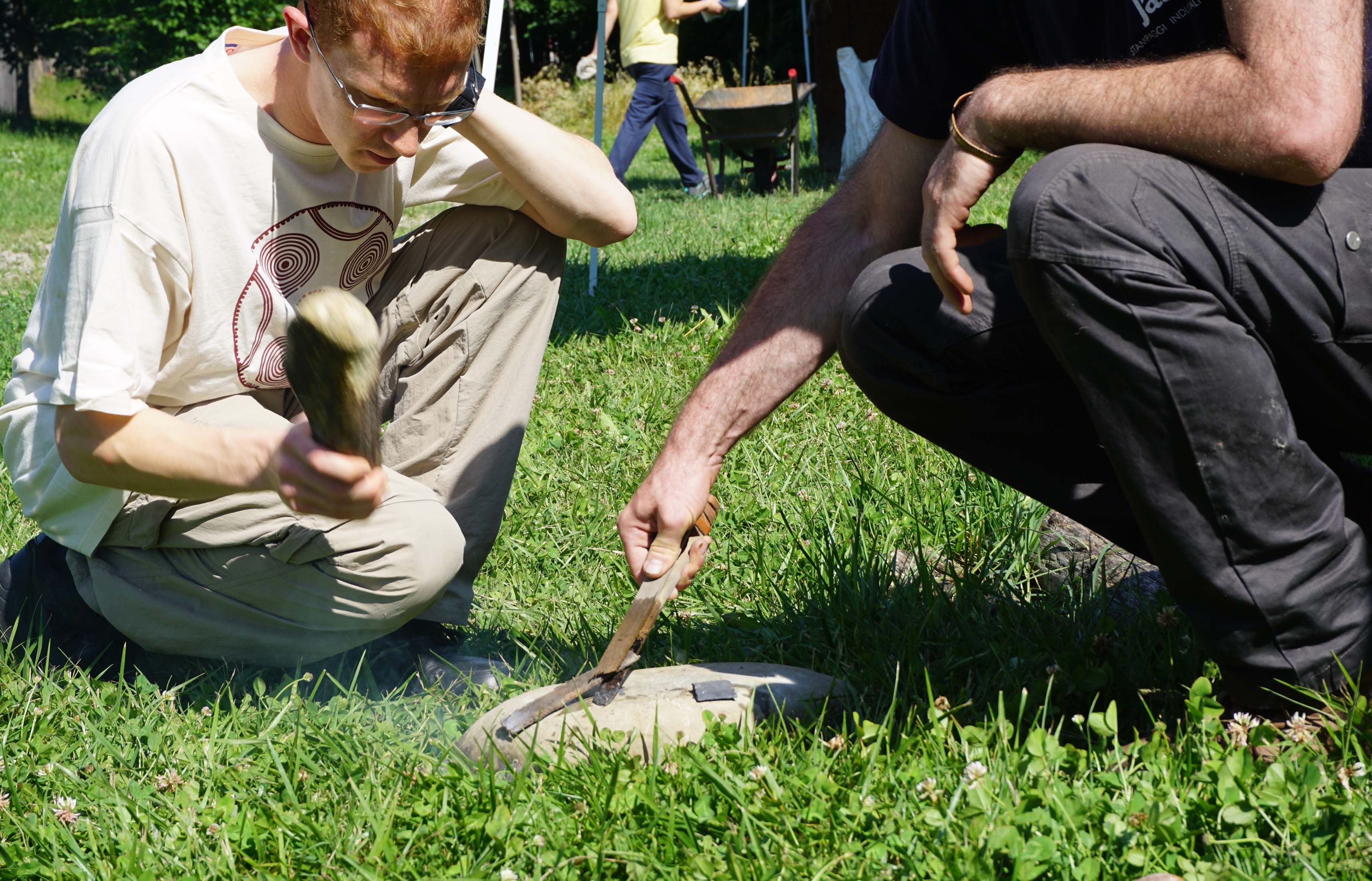
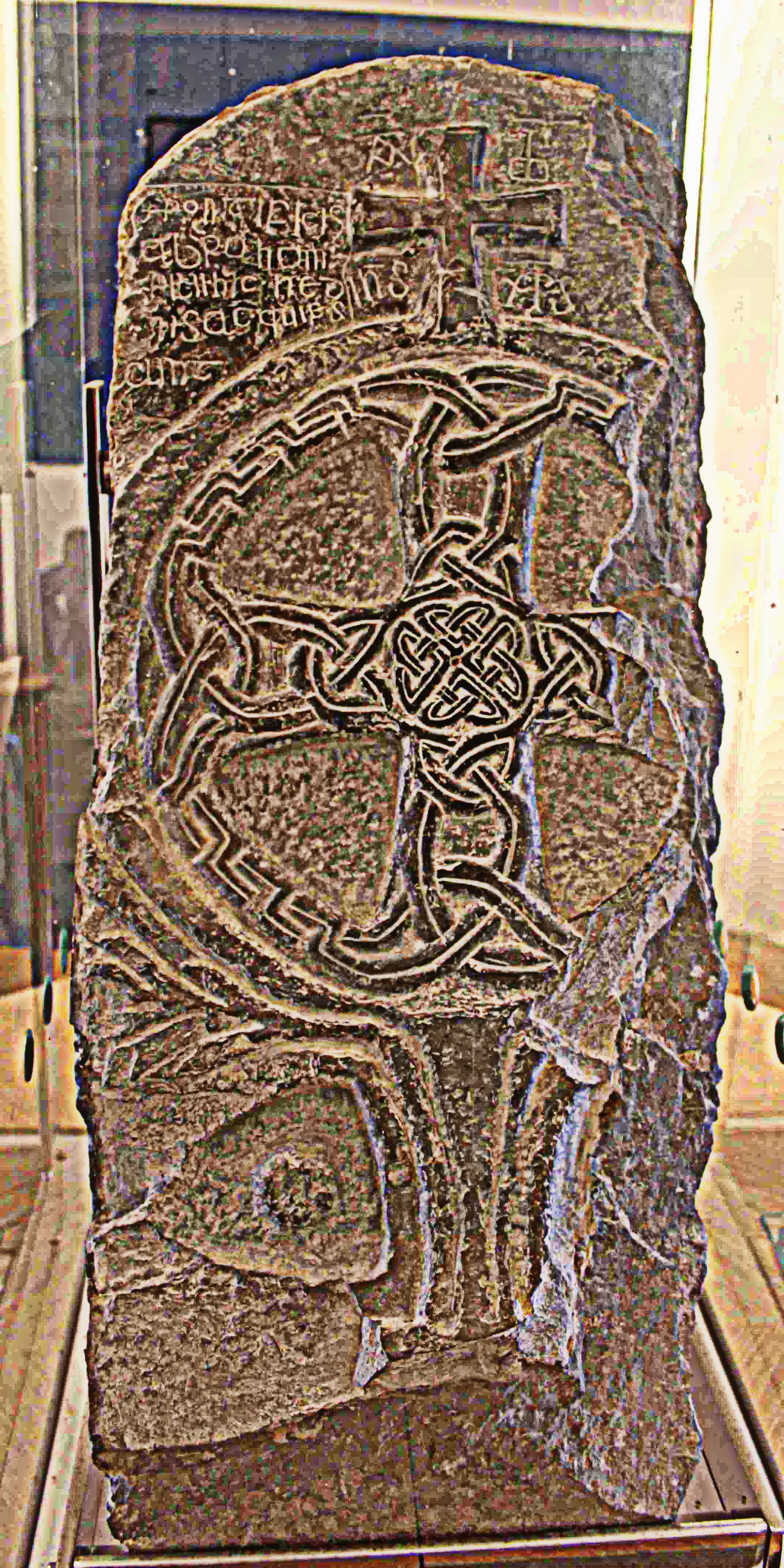
In a blog-post from 27th March 2018 it is stated that people love to destroy things.  But they also like to repair them! Today recycling and reuse is very important, but that is not new. Archaelogists all over the world have found items that seem to have been repaired to last longer. Broken pottery has been repaired by drilling holes and then tying shards together with organic materials (rope, leather) or metal staples. Rotten posts in longhouses have been replaced. Brooches have been reinforced with plates from precious metal like silver.         

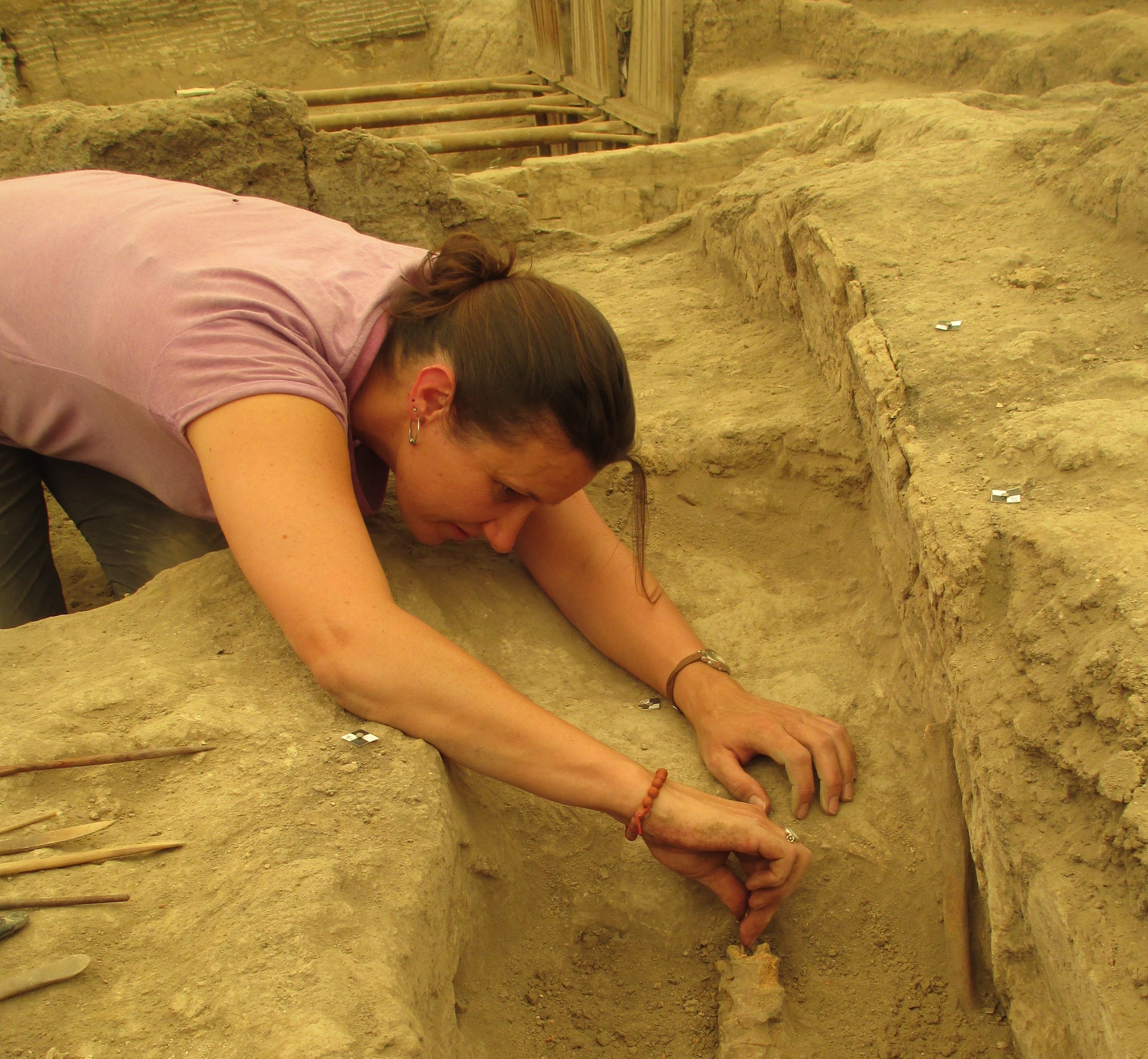
A considerable amount of repaired items have been found in Migration Period graves from the West coast of Norway (c. AD 400-550). This was the material I studied for my Master´s thesis. To find the items I had to search in the common archives of the Norwegian Museums. Most items where tagged with different words to describe a repair or reinforcement. Not all objects were in good condition, and sometimes the description only said that the object had a hole in it. On inspection I could see that the hole could possibly have been caused by a repair.

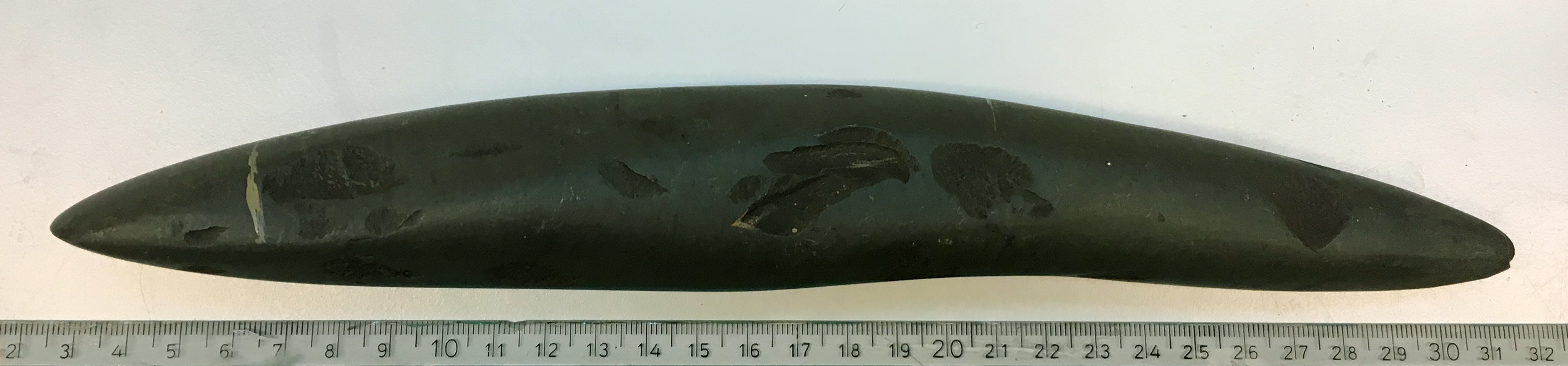
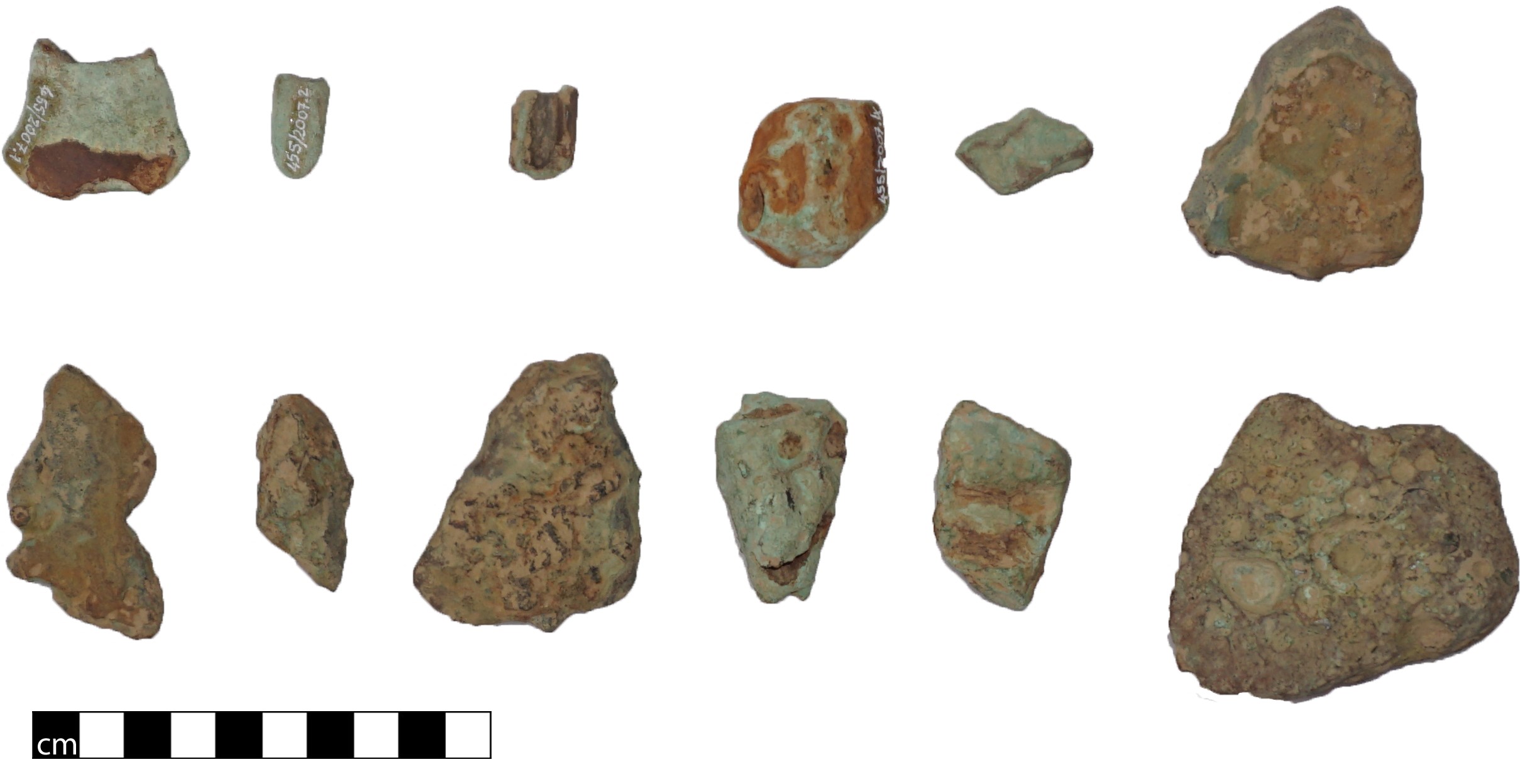
The repaired material from Migration Period Norway consists of glass vessels, pottery, bronze cauldrons and a few brooches. There are different kinds of techniques adapted to the material, but sometimes the techniques used on a material seems to imitate the technique used on a different material.

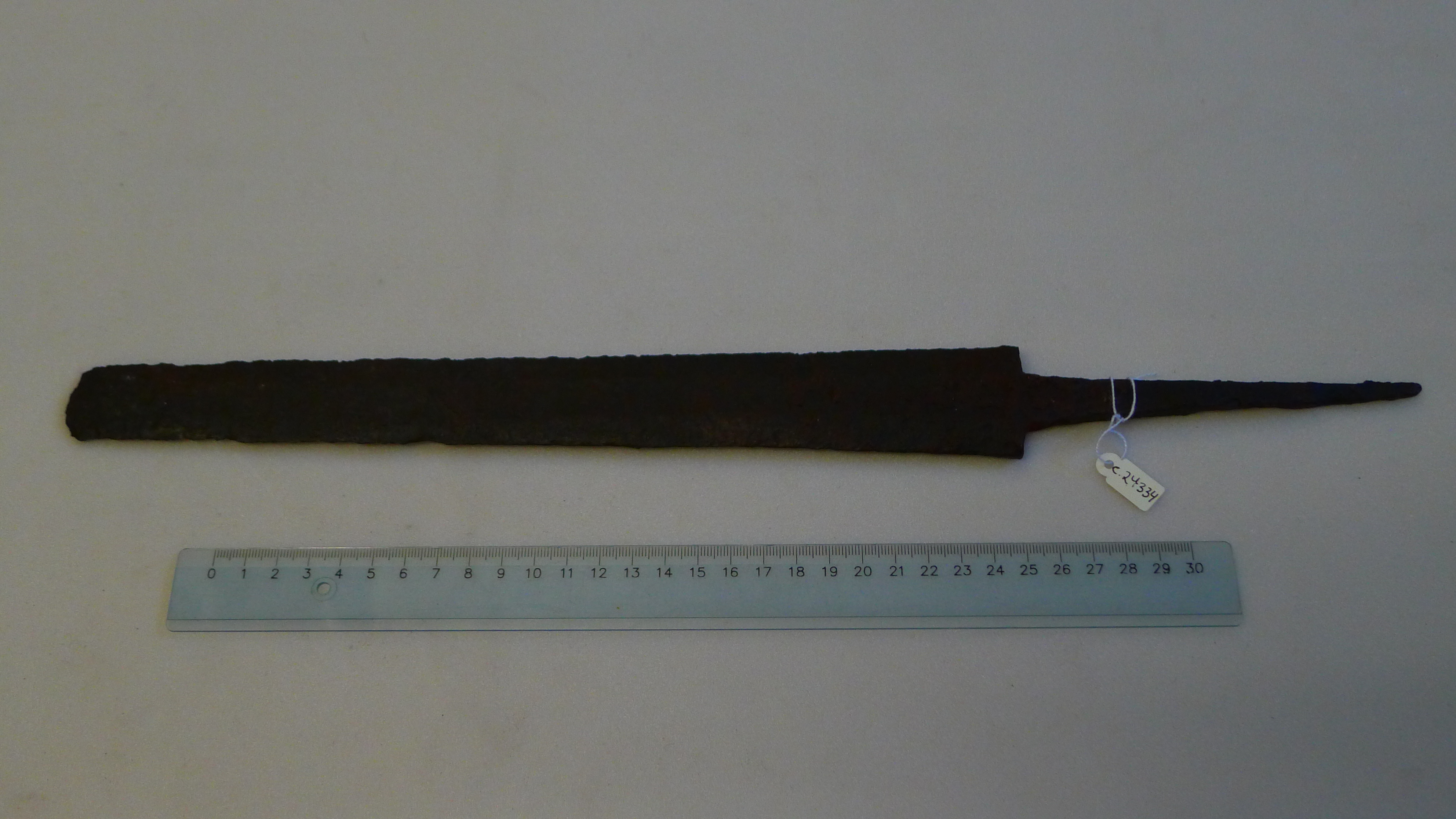
The glass vessels usually had fractures in them, and small holes had been drilled on each side of the crack. Drilling holes without making the the glass crack is a considerable feat. The crack had then been riveted together by pieces made from gold or silver. The glass was also often reinforced by placing a decorated goldband around the rim.

A remnant of decorated band around the rim, and a crack that is held together by a gilded fitting. Photo by Kristin Bakken.

The technique most often used on pottery was to make a new shard from clay. Then they drilled holes in the vessel, and pressed the wet clay from the new shard into the holes. That would create small plugs from the new shard through the holes, and made the new shard stick to the pottery. When it dried it would fit perfectly. Sometimes they recreated the decoration on the new shards.

Left: A new shard has been made. The decoration has been recreated on it. Right: Pieces from the new shard that have fallen off. They have little pegs from where the clay has been pushed through the drilled holes. Photo: Kristin Bakken.

A different technique on the pottery imitates the one used on glass. Holes would be drilled on each side of a crack, and then riveted together using iron staples.

A crack has been held together by iron staples on each side. The metal is gone, but the rust is still visible in the holes. Photo: Kristin Bakken.

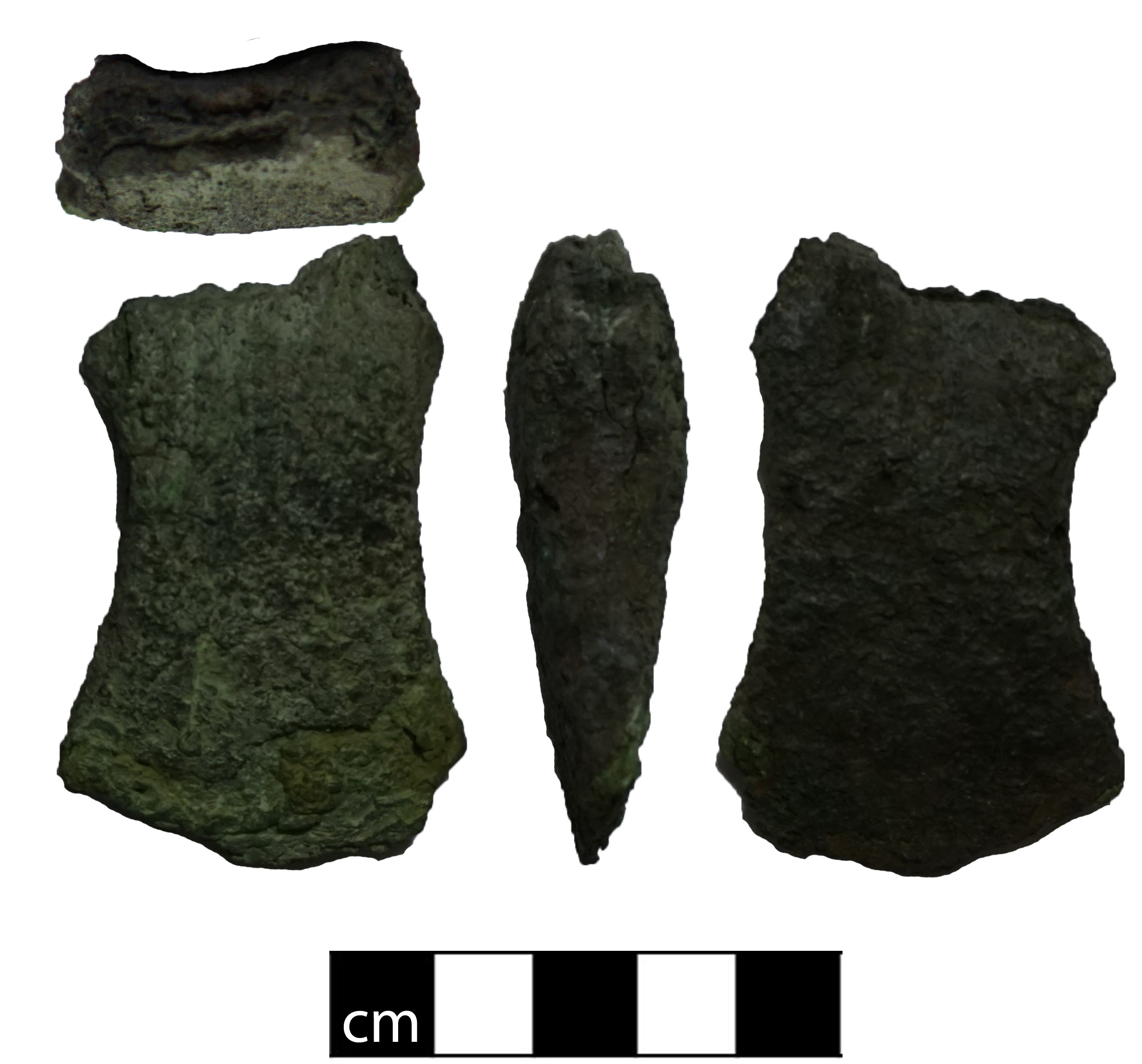
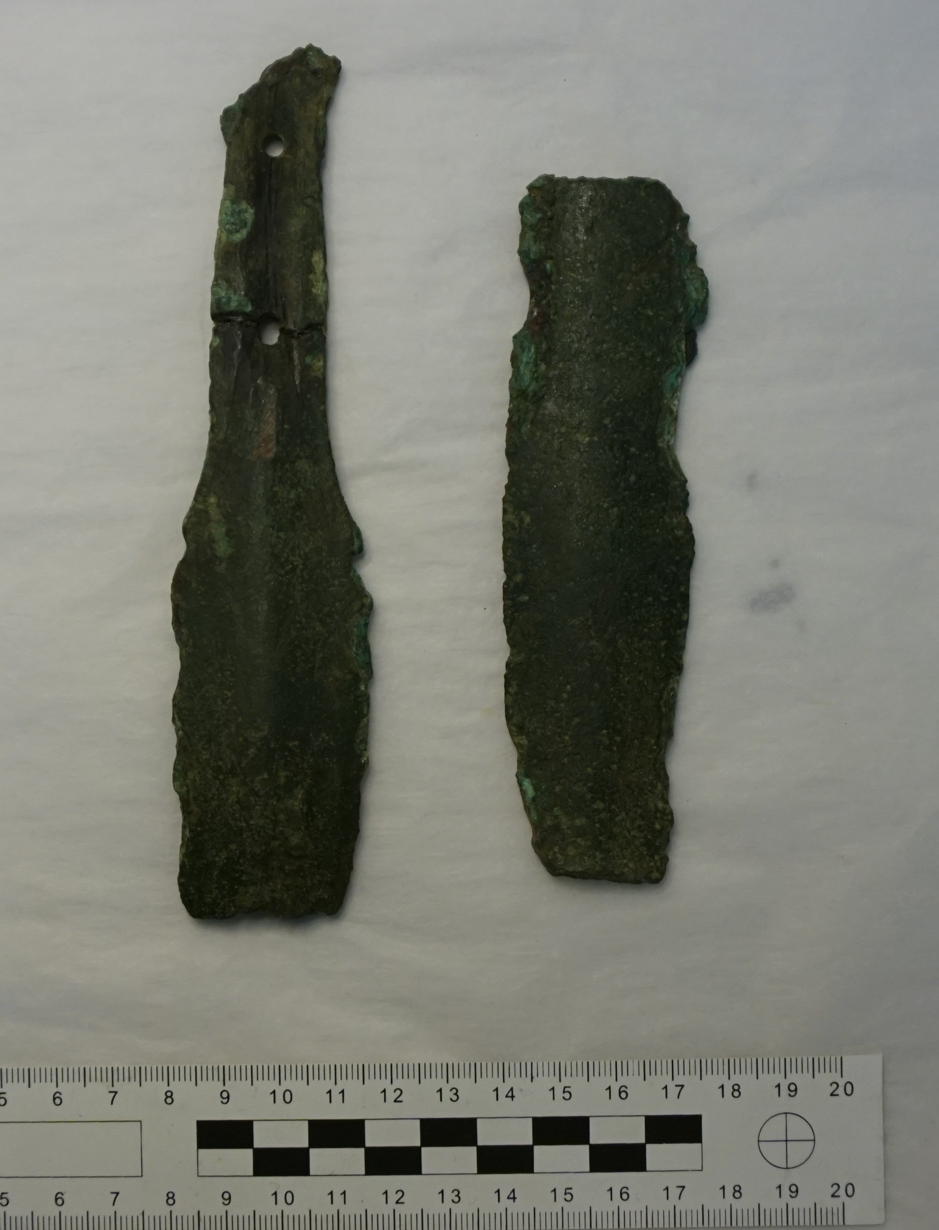
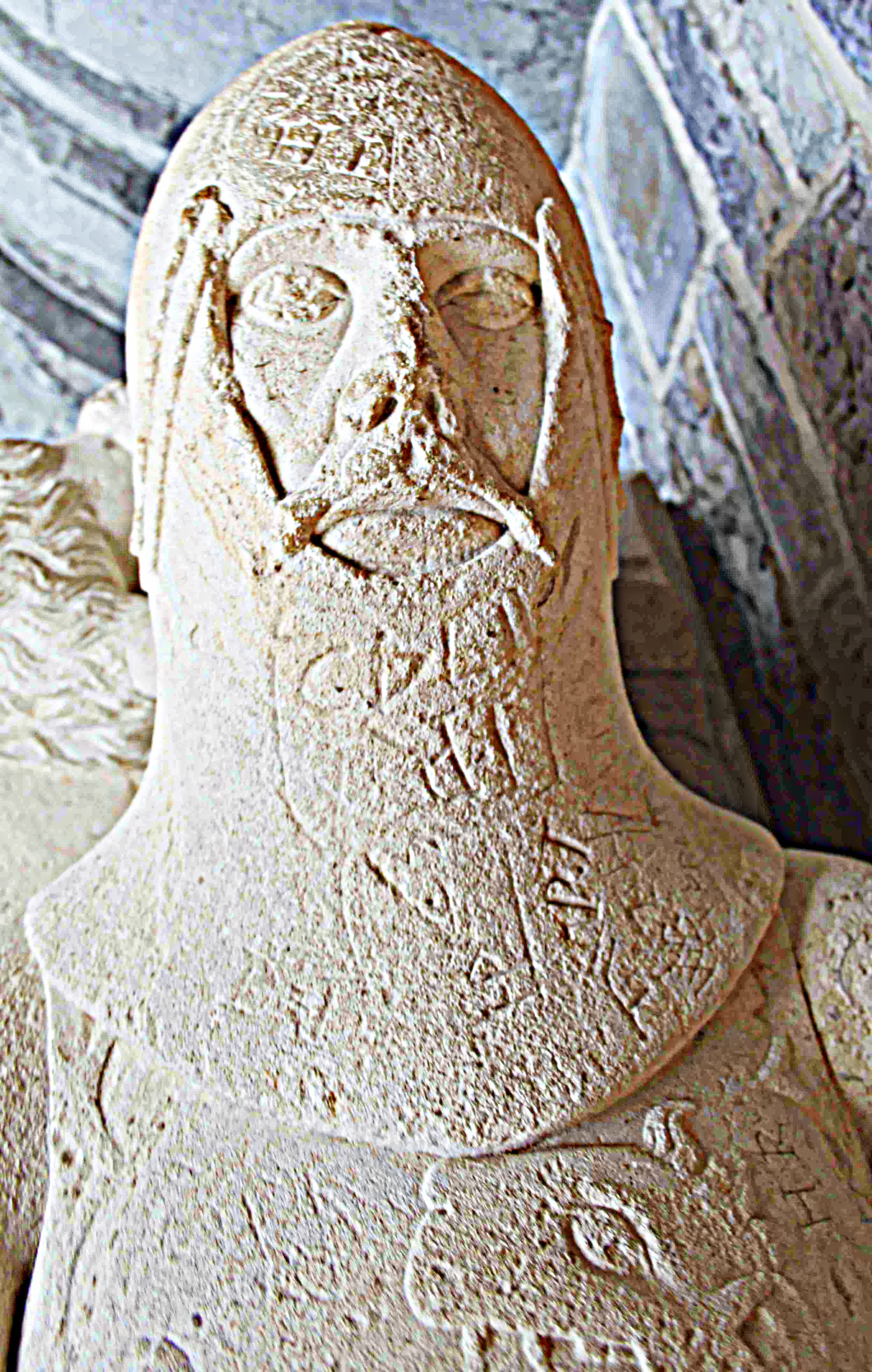
The bronze cauldrons were mended with bronze patches riveted over rifts or holes. Brooches were reinforced by patching the vulnerable area. One such patch on a brooch has rune inscriptions on it. They are intepreted to mean «this action». Some runes are missing, so the whole content is interpreted to have been «this repair will hold».

The most common thought about why they repaired their things is that they had few resources, so they could not just throw a broken glass or brooch away and go buy a new one. But that is not the only possible explanation. Some of the repairs on the Migration Period glass must have been made by highly skilled craftsmen with access to precious metals, like gold and silver. That does not fit with the explanation that they repaired things because they had few resources. They also repaired pottery made of easily available clay.

In this particular time and place, some of the repairs can be connected to the rise of high-quality ceramic- and goldsmith workers. The decorations on some of the repairs on glass are similar to decorations made on brooches from the same area. The runes on the repaired brooch could have been made by one of these craftsmen who was especially happy with his own work. So maybe they repaired so many things here simply because they could?

A third explanation concerns the age of the repaired things. The glass objects found in the graves were several generations old when they were deposited. It seems that even if they had the resources, they wouldn’t throw away the old glass for a new one. It had to be this particular glass. The glass had a history of its own and was connected to past people and events. That was important to people, and led them to repair things to make them survive longer.

It is funny how small details like repairs on grave materials brings us closer to indiviuals who lived and worked in the past, and how they were thinking about and treating their own past.

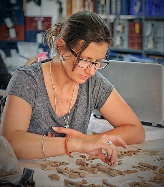
Kristin Bakken is a Norwegian archaeologist with an MA in Iron Age archaeology from the University of Oslo. She mostly works as a field archaeologist and is also a volunteer for the National Trust of Norway.

The story of Mesolithic quarries on the western coast of South-Norway

How did people think about stone adzes, the collection of raw material and quarries in Stone Age Norway? Could there be reasons beyond required qualities needed for making certain tools that made people quarry and distribute certain rocks? Can we tell by the volume of exploitation and scale of distribution and use whether stone from some places was considered more valuable than others?

Flint is the most commonly used raw material in many countries, as in Norway. However, there is no flint in Norwegian bedrock. Instead, nodules of flint had been redeposited with the help of ice-water and ice during the Ice Age. When the glaciers melted, ice that had covered areas with flint deposits further south broke loose and floated west and north with flint stuck to them. They stranded at the shores, melted, and made the sloping shores of the Norwegian coast treasure chests for Mesolithic and Neolithic raw material hunters. Hence also the colloquial name “beach flint”.

However, after the first two thousand years of settling along the Norwegian coast, something stirred in these societies. Some researchers suggest that mobile hunter-gatherers did not only move in from the south-east, but now also came from the north-east (e.g. Sørensen et al. 2013; Damlien 2016). This may have caused the apparent changes in tool types and the way one made them. Beach flint was no longer sufficient for making adzes. After 8000 BC, adzes were roughly shaped by knapping, and then ground into their final shape (Figure 1).

Figure 1. An example of the new type of greenstone adze made after 8000 BC in South Norway. (Photo: Astrid J. Nyland).

At this point in time, quarrying began. At first, a few sources were probably exploited repeatedly as a predictable supply of high quality rock. However, as millennia went by it became clear that a few sites must have come to mean more to the people that used them, than simply being sources of rock. An indication of significance beyond pragmatics may be the ‘refusal’ to abandon these quarries, even as the rock deposits were partly submerged by a transgressing sea, making other deposits more accessible.

Over time, the quarries on the western coast of South-Norway developed into the most monumental human-made sites of the Norwegian Stone Age that we know of. These are a diabase quarry at Stakalleneset in Flora, Sogn og Fjordane County (Figure 2), and the Hespriholmen greenstone quarry at Bømlo, Hordaland County (Figure 3).

Figure 2: Left: A massively exploited diabase dike at Stakalleneset, Flora, Sogn og Fjordane County. Right: Blanks, used knapping stones and waste of diabase found at the foot of the quarry. (Photo: Astrid J. Nyland)
Figure 2. Left: A massively exploited diabase dike at Stakalleneset, Flora, Sogn og Fjordane County. Right: Blanks, used knapping stones and waste of diabase found at the foot of the quarry. (Photo: Astrid J. Nyland).

Figure 3: The greenstone quarry Hespriholmen on an islet in the sea outside Bømlo, Hordaland County. (Photo: Astrid J. Nyland)
Figure 3. The greenstone quarry Hespriholmen on an islet in the sea outside Bømlo, Hordaland County. (Photo: Astrid J. Nyland).

These quarries were exploited from around 7500 BC to 2500 BC, and around 400 m3 were extracted. Hence, during more than 4000 years, the hollows and scars in the rock phase and tailing piles grew ever larger. The diabase and greenstone were distributed widely, but each type within a demarcated area that probably defined a social territory (Olsen and Alsaker 1984).

These quarries were not the sole providers of rock for adzes, but the particularities of the exploitation of these sites indicate that they gradually turned into social nodes too. In the Norwegian Stone Age, enduring man-made structures of stone were rare as most things were made of degradable materials. By the end of the Mesolithic, before 4000 BC, the mentioned quarries displayed deep scars and large waste piles that persisted for generations.

In ethnographic books, there are several examples of specific places being bestowed with social or symbolic meaning and power. Places can be related to origin myths or tales of other significant events in a society. In the case of the prehistoric quarries, there might have been value in the mere continuance of the quarrying tradition at a place where one saw solid proof of one’s ancestors endeavours (Nyland 2016a, 2017). Rock associated with these socially significant places would then also have become valued. Perhaps that was one reason for the wide distribution?

Dr. Astrid J. Nyland, Associate Professor, Museum of Archaeology, University of Stavanger, Norway. (Nyland has written a PhD (2016) about 21 quarries of various types of rock, located both at the coast and in the mountains, dating to the Stone, Bronze and Early Iron Age in South-Norway. The results that this blog post builds on have been published in several articles accessible from her page at academia.edu).

References

Damlien, H. 2014. Eastern Pioneers in Westernmost Territories? Current perspectives on Mesolithic hunter-gatherer large-scale interaction and migration within Northern Eurasia. Quaternary International. doi: 10.1016/j.quaint.2014.02.023

Nyland, A.J., 2016a. Humans in Motion and Places of Essence. Variations in rock procurement practices in the Stone, Bronze and Early Iron Ages in southern Norway. Unpublished PhD thesis. University of Oslo.

Nyland, A.J., 2017a. Materialized Taskscapes? – Mesolithic lithic procurement in Southern Norway. In: Rajala, U. & Mills, P. (eds.) Forms of Dwelling; 20 Years of Taskscapes in Archaeology. Oxford: Oxbow books, pp. 125–150.

Olsen, A. B. and Alsaker, S. 1984. Greenstone and Diabase Utilization in the Stone Age of Western Norway: Technological and socio-cultural aspects of axe and adze production and distribution. Norwegian Archaeological Review 17, 2: 71-103.

Sørensen, M., Rankama, T., Kankaanpää, J., Knutsson, K., Knutsson, H., Melvold, S., Eriksen, B. Valentin and Glørstad, H. 2013. The First Eastern Migrations of People and Knowledge into Scandinavia: Evidence from studies of Mesolithic technology, 9th-8th millenium BC. Norwegian Archaeological Review, 46, 1: 19-56.

Deliberate Destruction in the Bronze Age

People love to destroy things. Always have done. Always will. It is thus no surprise that the archaeological record is filled with deliberately damaged and buried objects. I became interested in this while studying a 3000-year-old Bronze Age axe at Somerset County Museum that had been broken in half, crushed and melted. How was it done? And why?

A broken, burnt and crushed socketed axe from Greylake in Somerset (author’s photo, courtesy of the South West Heritage Trust, Museums Service)

This was not an isolated instance. Deliberately destroyed Bronze Age metalwork is found across Europe. My curiosity in this phenomenon led to me undertaking a PhD in 2014. I began from the simple question: why did people destroy things?

This question has been debated for Bronze Age metalwork since the 1800s. However, few archaeologists have considered how metalwork was destroyed or how one might identify deliberate destruction.

Often Bronze Age metalwork is considered destroyed by its obvious nature. A sword bent in half and thrown in a river is certainly an intentional action; so is a group of bracelets crushed into a ball. I call this the ‘common sense’ approach to destruction. Broken axeheads found in the ground are often considered to have broken through overuse. Broken swords in the same situation are still considered to be deliberately destroyed though.

Broken sword pieces from Marazion, Cornwall (author’s photo, courtesy of the Royal Cornwall Museum)

This is problematic because it makes assumptions about what humans did to different objects without considering how it was done or the significance of different objects. Instead, modern assumptions about the importance of a sword over an axe are projected onto the past.

To tackle this, I studied many (many!) Bronze Age metal objects across my study region (South West England). I also commissioned Neil Burridge to produce experimental replicas of archaeological artefacts, including swords, spears and axes. I then tested different modes of destruction to see how easily one might break a Bronze Age metal object. The aim was to replicate prehistoric damage.

The easiest method for breaking a bronze object is to heat it and hit it. Stick a sword, spear, or axe into a fire, remove it and strike with a blunt object and it will usually fragment.

Me breaking a replica sword.
Me breaking a replica sword

Of course, it’s slightly more complicated than this, with factors such as the temperature and the metal composition of the objects playing important roles. Meanwhile, it is much more difficult to damage an object that has not been heated. Different conditions mean damage will occur in different ways. By identifying the various techniques used for destroying metalwork, we can begin to more clearly understand prehistoric techniques and decision-making processes.

These experiments thus added a new dimension to the study of metalwork in the South West in much the same way using replica swords in combat experiments helps us understand how these weapons were used in the past. Experimentally destroyed pieces could be compared with damaged archaeological artefacts to determine the likelihood that they were deliberately destroyed. This could be strengthened by analysing patterns of damage, as well as the depositional context in which objects were found (e.g. a hoard, a settlement or a burial).

The material from South West England was particularly interesting as a variety of practices occurred across the region. In the Early Bronze Age (c.2200-1600 BC), metalwork was burnt and broken with bodies during cremation. In the Middle Bronze Age (1600-1100 BC), gold objects or large hoards were most commonly damaged. By the Late Bronze Age (1100-800 BC), lots of metalwork destruction was taking place. It was more common to break axes and ingots in Cornwall and Devon and bury them in hoards.

A hoard of fragmented metalwork from Talaton, Devon (author’s photo, courtesy of the Royal Albert Memorial Museum, Exeter)

Meanwhile very little deliberate destruction was undertaken in Dorset. In Somerset, metalwork destruction was influenced by other areas. This means there was no overall pattern that could be observed. This indicates that destruction was not part of a uniform ideology. People undertook different practices at different times for different reasons. There is no ‘one-size-fits-all’ approach.

It is important to consider that it wasn’t just metalwork that was destroyed. Stone objects and ceramic vessels were also commonly destroyed. Additionally, roundhouses were often burnt and dismantled. The destruction of Bronze Age metalwork was part of a broader set of concepts that allowed people to express certain ideas. Some objects may have been destroyed for recycling. Meanwhile, others were destroyed for symbolic reasons, perhaps as votive offerings. These are ideas that archaeologists have been grappling with for decades. By combining these questions with an understanding of how destruction was done, we can begin to appreciate the skills, processes and decisions involved in the practice. This will ultimately give us a better understanding of the past, which after all is what archaeology is all about.

Acknowledgements: My thanks go to Neil Burridge for engaging with this project, as well as countless museums for accommodating research visits.

Matthew Knight is Curator of the Bronze Age collections at the National Museum of Scotland. Further details about his work can be accessed at: www.alifeinfragments.wordpress.com.


Mapping archaeological sites in Oslo

Being an archaeologist often means digging and finding artefacts. But a lot of work is also done from behind one’s desk. I work with heritage protection at the National Trust of Norway, mostly with buildings from the 18th century onwards. The trust applies for funding for different projects, one of those projects was creating a map of historic buildings in an area of Oslo, Norway, with the support of a trust called Sparebankstiftelsen DNB. The aim of the project was to make local heritage accessible to everyone. The project resulted in an online map, a folder, and a guided tour of the area.

There was still money left after the project was finished, and last year we decided to also map archaeological finds and old farms in the area. The oldest buldings that were registered in the previous map were built the 17th century, so we decided to map finds and place-names from the Stone Age up until the medieval period (10,000 BC – AD 1537).

To start the research, I checked the Norwegian heritage databases. Norway has two heritage databases where most finds, sites and buildings in Norway are registrered: Askeladden is for heritage professionals and requires a log in, while Kulturminnesøk is open to everyone. I also visited the archives at the Museum of Cultural History, they have documents concerning archaeological finds. Many of the finds were found in the 19th century, and this information is not always available online. I also read reports from the Agency for Heritage Management in Oslo, they are responsible for archaeological registration projects in Oslo. A lot of books and articles about Oslo’s prehistory were also consulted. Finally, I checked references to old farm-names. Some of the farm names still exist, but we cannot know that they were in the same location.

After making a list of the finds, I visited the Museum of Cultural History again. Most of the artefacts are stored there, and it is possible to look at the artefacts and take pictures. In the end, a total of 49 archaeological finds and old farms were chosen to be included in the map. I then had to rewrite the information I had gathered to make them presentable online. Following are some snippets from the exciting finds:

The heritage map. Stone Age finds (green), Iron Age finds (blue), medieval structures (orange), farms from the Iron Age (red). Illustration: Anne Grandt, The National Trust of Norway.

The earliest finds are from around 5000 BC, the later part of the Norwegian Early Stone Age, before agriculture was introduced. These finds are from an archaeological culture called the Nøstvet-culture. One is an axe that was found alone, while a big settlement was found where one of the major roads through town is located today. The remaining Stone Age finds are from the Later Stone Age (4000-1800 BC), mostly axes. There are no Bronze Age artefacts on the map, but some archaeological structures discovered by the Agency for Heritage Management have been dated to the Bronze Age (1800-500 BC).

Axes from the Later Stone Age (4000-1800 BC) found in Oslo. Photo: Linn Marie Krogsrud, courtesy of the Museum of Cultural History.

The majority of the archeological finds can be dated to the Iron Age (500 BC – AD 1050), more specifically the Viking Age (AD 800-1050). It is evident that the area was important and relatively densely populated in this period. Most of the finds are artefacts from graves, such as swords, axes and spear heads. Some burial mounds are still preserved, but they have not been excavated.

Artefacts from a Viking Age burial (AD 800-1050) found in Oslo. Photo: Linn Marie Krogsrud, courtesy of the Museum of Cultural History.

There are also structures that were constructed in the medieval period (AD 1050-1537). One of the structures is a church from the early 12th century that still stands. An old mine still exists beneath the church, the mine was probably exploited already in the 12th century. Two roads still in existence can be dated to the medieval period, but we cannot be sure that they followed the exact same route as today. They are both mentioned in historical records.

Iron sword from the Roman period (AD 0-400) found in Oslo. Photo: Linn Marie Krogsrud, courtesy of the Museum of Cultural History.

The remaining sites that were researched were 14 old farms. We know that they were in existence in the Iron Age, as we can date the names. Historical records from the medieval period mention the farms, so we know that many of them survived. Some of them exist even today, but it is possible that they were moved several times during their long history. Some of the farms are long gone, and only their names attest to their existence. Interestingly, many of the Iron Age artefacts have been found near were some of the farms are located today.

The aim of the project was to map the history of a part of Oslo. We want people to explore the area on their own, and both maps are available from our office and online.

www.fortidsminneforeningen.no/oa/kulturminnekart/eldre-tids-kulturminner (In Norwegian).

Linn Marie Krogsrud is a Norwegian archaeologist, she works for the National Trust of Norway.

What Archaeological Features can tell us about the Past

When people hear that I am an archaeologist they usually want to know if I have ever found anything interesting on an excavation. I usually tell them about the blue glass beads which I found on our excavation at Meillionydd, near Rhiw on the Llŷn peninsula in Northwest Wales (UK). To me these beads are special because they were hard to spot – tiny and covered in soil as they were. However, from an archaeological viewpoint those beads are hardly something to be excited about. They do not tell us much about the site or the people who once lived there.

One of the glass beads found at Meillionydd in 2014 in situ.

What is much more interesting to me as an archaeologist are the features that we excavate. Meillionydd is a double ringwork enclosure, a settlement that at some point during its existence was surrounded by two banks. If you are on site today – outside of our excavation season – you will hardly notice the remains of the banks, because they were slighted at some point.

The glass beads from Meillionydd in their cleaned state.

However, underneath a few centimetres of grass and soil there remains plenty of archaeological evidence. Thanks to our excavations and a Ground Penetrating Radar (GPR) survey, which was carried out by the ZAMG in 2012, we know that the site started out as an unenclosed settlement consisting of timber roundhouses. The settlement was surrounded by a ditch and a wooden palisade at a later stage, until both of these features were replaced by two earth and stone banks. At roughly the same time, the timber roundhouses were replaced by stone built roundhouses. The GPR interpretation shows that there were around 100 roundhouses on site. We do know that these houses were not built all at once, because they intersect with each other and, therefore, cannot have existed at the same time.

Interpretation of the 2012 GPR survey highlighting the ditch (brown) and - where possible - different types of roundhouses (blue = unspecified roundhouse, yellow = timber roundhouse & green = stone roundhouse) potentially present on site. Furthermore, it includes Trenches 1, 2 and 3 in different stages of excavation.
Interpretation of the 2012 GPR survey highlighting the ditch (brown) and – where possible – different types of roundhouses (blue = unspecified roundhouse, yellow = timber roundhouse & green = stone roundhouse) potentially present on site. Furthermore, it includes Trenches 1, 2 and 3 in different stages of excavation.


Archaeologists usually use pottery or other finds to date sites or specific features on sites. Unfortunately, people in Wales stopped using pottery during the Late Bronze Age and only started using it again after the Roman invasion in the first century AD. In fact, at Meillionydd we find hardly any finds except for stone tools, which are chronologically unspecific and thus cannot be used for dating the site. In the absence of finds, the only absolute dating method that we can use is radiocarbon dating. For this purpose we collect charcoal samples. The two samples that we had analysed as of yet give us a range of 500 years, from the 8th to the 3rd century BC, during which the site was in use. We are planning to use this method to date most features on site.


Where we do not find charcoal, the only method we can use to date features is stratigraphy. While this method does not give us actual dates for features, it does tell us if features are older or younger than others. When you use the stratigraphic method you look at how features overlap and/or intersect with each other. For example, at Meillionydd we found the remains of a roundhouse next to the entrance through the outer bank. When we first started to excavate this feature in 2012 it looked like the roundhouse was cut into the outer bank. It seemed likely that it was built at a later stage than the bank and that part of the bank had been cut away to build the roundhouse.

Plan of the 2010 to 2015 excavations at Meillionydd. Banks indicated in grey, roundhouses as coloured circles. Roundhouse with drainage gully at the end of the southern terminal of the outer bank highlighted by red square.


However, when excavating the entrance through the outer bank in 2014 we realised that the drainage gully of the roundhouse runs underneath the bank. For the gully to be underneath the bank it must have been dug before the bank was build. Therefore, the gully and the roundhouse must have been built before the bank was built. Combined with other evidence it seems likely that both the roundhouse and the bank were built roughly at the same time and that the roundhouse functioned as a gate house.

This example explains how archaeological features give insights into the past and why an undisturbed, well documented stratigraphy is important. At this point, most of the dating at Meillionydd has been done through stratigraphy. Without this method we would not have been able to say how the settlement developed. The undisturbed stratigraphy on site enables us to gain valuable information that might be lost otherwise.

For more information on the Meillionydd excavations, please visit the website (http://meillionydd.bangor.ac.uk/) or follow us on Facebook (https://www.facebook.com/meillionydddig/) and Twitter (https://twitter.com/Meillionydddig).

Katharina Möller is a German archaeologist with an interest in Public and Community archaeology. She is an Honorary Research Associate and a PhD student at the School of History and Archaeology at Bangor University (UK). Since 2013 she co-directs the excavations at Meillionydd together with her colleague Raimund Karl.

The Hunter, The Dog Men, and the House by the Shore: How an archaeologist writes an archaeological novel.

To begin with, I have a wide range of interests, including experimental archaeology which provides a fusion between my environmental knowledge, interests in Palaeolithic and Mesolithic archaeology and my fascination in the Prehistoric use of organic materials.

A major recent project for me has been to work on the west coast of Scotland trying to establish how Mesolithic hunter-gatherers were living.  I did this by restricting myself to the natural resources and tool kit of a Mesolithic hunter-gatherer so that I could I go through similar thought processes and experiences. Using experimental archaeology and bushcraft skills to fill in some of the gaps in the archaeological record, the human facets that are often missing. Making and testing a wide range of fishing gear, travelling thousands of miles over 4 years and starting to feel like a Mesolithic hunter-gatherer; lugging fishing gear to remote sites, planning to maximise the use of tides, and often experiencing awful weather.

Pete in snow

These experiences provided me with an insight into the world of the Prehistoric coastal hunter-gatherer, revealing the extent of organisation and knowledge that they must have had in order to fully utilise their environment. The planning needed to maximise returns, whether foraging, hunting or collecting natural resources.

Experimental archaeology is often used to engage public interest in our past, most notably through reconstruction or experiential learning. With a view to further communicating our understanding of the Mesolithic to a wider audience I recently wrote a novel; The Hunter, The Dog Men and the House by the Shore.

I had three objectives in mind.

Firstly, to illustrate what a fascinating and diverse ecosystem we have lost in the UK since the Mesolithic. With over 30 years’ experience in the environmental sector, I have long been aware of the relationship between human activities, however small, and their environmental consequences. The environmental and ecological knowledge required; the places to find the best materials for a particular task, knowledge of seasons and the seasonal movement of species. When and where to be, at a particular place at a particular time of year. My novel takes the reader on a journey through north-west England (what is now Merseyside, Cheshire and North Staffordshire), 8000 years ago, in a landscape where aurochs, elk, wolf, lynx and wild boar roam.

Secondly, to bring to the modern reader an insight into the daily lives of Mesolithic hunter-gatherers, the food they ate, how they might have cooked it, how they travelled, the tools, the buildings, the boats. The novel is based on the latest archaeological research and is packed full of natural history and bushcraft skills. The main character is a lone Prehistoric hunter who works his way through this diverse and changing landscape. On his travels he encounters a range of characters; from traders to killers and ultimately meets his new mate who lives in a house by the shore.

Thirdly, to demonstrate the extensive skills and knowledge that our ancestors would have employed day in, day out, skills that most people now lack. As an experimental archaeologist I use ancient technologies and bushcraft skills to understand how our ancestors used to live.  Some of my projects have included; stone and bone bead making in Romania, tree bast comparisons in Denmark, skin-on-frame boat building, and Neanderthal birch bark tar production. In short, a range of exciting and fascinating projects that have provided me with a genuine insight into the range of skills required by our Prehistoric ancestors.

It is of course very difficult to understand the mind-set of someone who lived 8000 years ago, but by using some of those ancient hunter-gatherer skills together with experimental archaeology, we can move some way toward them.

The Hunter, The Dog Men and the House by the Shore

Peter Groom has a PhD in Mesolithic Archaeology, is a freelance experimental archaeologist and primitive skills/bushcraft practitioner, a founding member of the Mesolithic Resource Group and is the course manager and principal instructor of the Environmental Archaeology and Primitive Skills course at Reaseheath College. He lives in Staffordshire, England.


The novel is available to purchase via Amazon: https://www.amazon.co.uk/Hunter-Dog-Men-House-Shore/dp/153981971X/ref=sr_1_1?ie=UTF8&qid=1478876612&sr=8-1&keywords=The+Hunter%2C+The+Dog+Men+and+the+House+by+the+Shore


A Heritage Walk for Hearing Impaired Children

GoUNESCO Make Heritage Fun – Calcutta, March 2017

INTRODUCTION
On 27th March 2017, Heritage Walk Calcutta, in collaboration with Made in Bengal and ArchaeologistsEngage, hosted the year’s first GoUNESCO Make Heritage Fun event in Kolkata, India. Make Heritage Fun is a global initiative by GoUNESCO, aimed at celebrating local culture—simultaneously, across the world. This campaign provides a platform for heritage and culture enthusiasts to share local heritage with others in their community. In Calcutta, we organized an event to help children with hearing-related disabilities explore Calcutta’s history through a guided and assisted 2-hour walking tour inside the compound of St. John’s Church, one of the oldest in the city. For this event, we were proud to work with the Ideal School for the Deaf, located in Salt Lake, Kolkata. 26 of their students from 6th to 10th grade (12-17 years old) and 6 teachers actively participated in this event. The tour was led by Tathagata Neogi, an archaeologist and the co-founder of Heritage Walk Calcutta, and translated into sign language by the accompanying teachers.

DSC01106

After the walking tour, we asked the children to create a work of art about what they learned during the walk.  When ready, these paintings/sketches will be shared through our online platforms and displayed during an exhibition at the Ideal School for the Deaf later this year.

The following is a link to the live telecast at the beginning of the walk.
https://www.facebook.com/heritagewalkcal/videos/1473483729360771/

VISION
The accessibility of historic sites is an issue that has not been widely addressed globally. While some countries have recently passed legislation to ensure the accessibility of major historic sites for various groups with disabilities, this issue has not been systematically addressed in India, despite the country’s rich tangible and intangible heritage, and large population of people with disabilities. By conducting a heritage walk specifically aimed at children with hearing-related disabilities under the GoUNESCO Make Heritage Fun umbrella, we at Heritage Walk Calcutta wanted to start a discussion about the issue of accessibility in India’s historic sites. Heritage Walk Calcutta and our collaborators believe in a common, shared heritage, which members of disabled communities have an equal right to access.

DSC01119DSC01137PREPARATION
Heritage Walk Calcutta approached GoUNESCO about hosting this event under the Make Heritage Fun umbrella at the end of February. The original plan was to provide a bus tour of several major heritage sites for school children. When GoUNESCO approved our application to host an event, this idea was further refined in the hope of addressing accessibility issues in Indian heritage sites. At this time, our collaborators, Made in Bengal and ArchaeologistsEngage, came on board to provide support for the event. The idea of a bus tour was abandoned in favour of a walking tour to increase the experiential value of the event, and to give ample time for the children to connect with a single historic site in a deeper way.

The St. John’s Church complex was chosen as the venue because of its central location and historical importance as the first Anglican Cathedral of Calcutta. The church compound also houses the graves of Job Charnock, the “founder” of the city, and some other important East India Company personalities from the city’s very early days. The Church complex is also a protected site under the Archaeological Survey of India, which is a perfect setting to start discussions about the accessibility of heritage sites, and which does not have any restrictions on entry. Finally, since the children have hearing-related disabilities, the church compound provided safety from the fast moving traffic on some busiest streets in Kolkata, just outside the walls.

DSC01224

After this plan was finalized, we approached the Ideal School for the Deaf through a common friend. Their authorities were very enthusiastic about the event. We discussed our plan with the head of the institute and other faculty members to come up with an accessible narrative for the children. The school requested that the event be done on Monday, March 27th, rather than on Sunday, which was the day of the international event. GoUNESCO very kindly agreed to let us host the event on this alternate day to make it easier for the children to attend, since many of them come from very far distances to attend the school. The Friday before the event, Tathagata made a presentation at the school to give the children some historical context through pictures and paintings, with translation into sign language. This also provided us, the students, and the teachers with a warm-up run for the event.

DSC01243

To ensure the accessibility of the information during the walking tour, we prepared visual aids for the children. This included print outs of important names, dates and numbers in large fonts and visible colours. Tathagata also spoke slowly in Bangla so that the children, who are experts in lip-reading, could get some information immediately, without waiting for the translation. Both Tathagata and the teacher who was interpreting stood on higher ground whenever possible throughout the tour so that all of the children could easily see them. A small welcome kit was also provided for the children and their teachers, which included a bottle of water and some snacks.

Group

FUTURE DIRECTIONS
The issue of the accessibility of historic sites is very close to our hearts at Heritage Walk Calcutta. We believe that, while one-off events like these can spark a discussion, this talk will die out if it is not regularly followed up by similar events and workshops. Heritage Walk Calcutta is therefore committed to making significant contributions to this discussion by organizing follow-up events for various disabled groups and by working with different stakeholders to make heritage sites more accessible for disabled communities.

Heritage Walk Calcutta is an academic-run company in Kolkata that aims to increase awareness of heritage in the community by connecting scholars and the common people through walking tours and workshops.

Tathagata Neogi is an archaeologist and the co-founder of Heritage Walk Calcutta.

OUR COLLABORATORS
The event would not be possible without the active support of our various collaborators and GoUNESCO. Here, I briefly introduce our collaborators and thank them for their support.

Ideal School for the Deaf: Established in 1967 by the Society for the Deaf, the school functions as a not for profit institution to provide free education for hearing impaired children. The organization is based out of Salt Lake Sector I, Kolkata, India. The school caters to students from all backgrounds in the Kolkata area and beyond.

Made in Bengal: ‘Made in Bengal.in’ is a digital platform for any product/service made by the people of Bengal..in Bengal…for the people of the world. The Made in Bengal team constantly work with artists, artisans and weavers to innovate in order to keep traditional techniques intact! The aim is to bring on more artists, manufacturers, designers, weavers, musicians, theatre artists, and so on, to this single e-platform and reach out to the world with our products, culture, art and cuisine.

ArchaeologistsEngage: ArchaeologistsEngage is an independent non-profit group of archaeologists who came together to enable engagement between professionals and the public. ArchaeologistsEngage is a registered voluntary organisation in the Norwegian Brønnøysund Register.


Stones and people: how do we determine function?

As you may have understood from this blog, archaeologists do many things outside of The Excavation. One such thing happens after something has been dug. When something is discovered, it often has undefined entities. While you can often tell that something was manipulated by humans, it is rarer to immediately see what the thing in question was for. Most often, finds have to go through a period of analysis to bear meaning, and certainly to be relevant for our understanding of the entire excavation as a whole.

One type of analysis is functional analysis of lithics. Through thousands, and sometimes millions of years, stones have been worked into specific types of tools.  But, even if something looks like an axe today, that doesn’t mean that it was in fact an axe thousands of years ago. We therefore carefully investigate each artefact, first to group and label them for magazines, and later to research their actual role in our society. The latter can be achieved by many means, such as residue analysis or placement on a site (for instance in a grave). However, sometimes we want to look at the practical function that a stone tool had, and we often do this through experimental means. One method that is closely linked to experimental archaeology, is use-wear analysis. Through this method, a researcher will scrutinise the tool for worn facets or edges under a microscope, and look at the patterning of the wear. Sometimes it may be criss-cross scratches, sometimes chipped edges, sometimes patches that are worn to the extent that they shine. Often, these traces are not visible to the naked eye, and we use a variety of microscopes to get the best or most detailed view of the pattern. Then, ideally the archaeologists will aim to create a replica pattern, and this is done through experimentation.

For instance, an axe will be investigated along the axe edge to determine whether it was a) used at all, b) heavily worn, and c) what the pattern looks like. After that, the archaeologist will make a replica tool and use it in one or more fashions to see if the resulting wear pattern is similar to the one on the archaeological tool.

Last year, I made a use-wear analysis of my own, on a mysterious find category from the Norwegian Mesolithic period. The tools are typically found along the coast, and often in relation to settlement sites. The artefact type consists of a hand sized beach pebble with one or two heavily worn facets, usually on either side of the stone. Not only are the stones worn, but the facets are also carefully prepared prior to use, by pecking at them with another stone. But, no one really knows what they were for, and I set out to try and come closer to this mystery.

One of the mysterious stones (C53854/22 from Rørbekk 1, Svinesund, Norway)

So, I had to come up with a number of tasks that people in the Mesolithic may have done with such a tool. Then I did those tasks with replicated tools, in the hope that I would make a pattern similar to the archaeological ones. Out in the woods, I cracked 6 kg of hazelnuts, and with other stones I ground them up. Neither of the wear patterns showed any similarity to the real stones. But, with a third set of stones I bashed up some dried deer sinew, and this pattern of wear was almost identical to the archaeological stones.

Hazelnut cracking with replica tool well under way.

Separated deer sinew after 20 minutes of bashing.

In hindsight, I should probably also have rubbed some hides with the stones, as the wear trace did indicate that the stones were used on a soft, pliable surface. I will hopefully have the opportunity to go back and do that another day. But for now, a preliminary interpretation is that the stones were used with something soft that is most likely not a plant material, but not as soft as meat. It could very well be that inhabitants of the coastal settlement sites in Mesolithic Norway used these little stones to soften dried sinew before they used it to haft arrows and harpoons, or sew seal skins into bags, clothes, or tents. With more experiments, we may find out!

Tine Schenck is an experimental archaeologist with a special interest in Boreal, seasonal exploitation of resources.

Revealing the person behind the bones.

Like many people, I’ve always been interested in the past and how people lived their lives. Historical accounts that have survived through time can tell us so much about what life was like, but they also have their limitations. One aspect that frustrated me was that these accounts didn’t really get close enough to the person behind the image, which was what I actually wanted to know about. So it seemed like a good idea to go directly to the people themselves for this level of information.

I have read some wonderful archaeological reports on excavated sites that provide incredible details on the buildings, pottery, stone, glass, preserved grains, animal and human bones. They allow the reader to really get to grips with what was going on at the location in the past. The physical aspects of the people who died and were buried at an excavated location can be determined through analysis giving us detail about demography (age and sex) and pathology (dental health, arthritis, injury). This information is vastly different to historical accounts in terms of the level of detail and in providing direct access to specific individuals.

The human skeleton is a record in bone of that person’s physical life experience. All of the detailed information that can be gathered from analysing a skeleton can be reconstructed to give us a very personal knowledge of one individual. We can understand aspects of their early childhood and movement through life, diseases and trauma they suffered from, and possibly survived, activities they undertook, and even if they were left- or right-handed. This is essentially what I do through my research. I focus on a specific group of individuals, the youngest ones. They are a very special group because their skeletons give me information about two individuals; themselves and their mothers.

In the UK, if excavated human remains are not reburied, they are stored securely according to the regulations for the treatment of human remains. Any analysis and research must follow ethical requirements and be carried out by trained individuals. A large part of my research time is spent working in secure-access locations with lots of boxes of bones. Occasionally I have the opportunity to excavate the remains on site, which is hard work but fun. Most recently my fieldwork has been in a very hot, dry environment, so it’s certainly a change of scenery from basement storage areas!

Storage
Secure storage area for human skeletal remains recovered from archaeological contexts.


Lifting fragile remains uncovered during excavation.

As an osteoarchaeologist, I’m normally only involved in excavation where burials are concerned. This means that I can ensure that the remains are being dealt with correctly and that nothing is overlooked. On a busy site, my role is to advise and oversee the exposure (uncovering) of burials. Once the remains are visible I then complete the excavation of the skeleton. After a skeleton is lifted, it is gently cleaned, labelled and stored. Then it is possible for the remains to be analysed in detail. Occasionally, there are multiple burials with mixing up of the bones. This means that there is a long process after cleaning of separating the individuals; much like a big, complex puzzle with lots of tiny pieces.

Sorting skeletal remains from a multiple burial.

Analysing a skeleton allows me to understand specific impacts that an individual experienced before their death and how this affected their life. Looking at the context of their burial lets me see how the other people around them responded to their death. The combination of these two factors is about as close as we can currently get to ‘knowing’ past individuals. Other specialists can provide further details on where these past people grew up, their diet, and perhaps how they looked. Knowing about the end of their lives and how their community reacted to their death tells us something else, something that cannot be easily measured. It can reveal that they were important in their community, regardless of age or sex, or status. It can re-write our interpretations of how past people thought about each other, and where they drew distinctions.

As interesting as this line of work is, it’s important to remember that all of the information we gain from studying past people comes with a catch; every interpretation we make is informed by our own reality. It is impossible to separate our own experience from what we think about someone else’s. The best we can do is get close to finding these lost people amongst all the evidence, and giving them back a voice. This is one of the goals that I strive to achieve through my work.

Belinda Tibbetts is a PhD Candidate in the Archaeology Department at the University of Exeter.

The Medieval ‘Living Dead’

As a mortuary archaeologist, I explore graves and tombs, memorials and monuments, buildings and landscapes. I look not only at spaces dedicated to the dead and their memory – cemeteries and mausolea, but also how the dead, in many societies and cultures, are integrated into domestic and public, sacred and secular buildings.

In 21st-century multi-faith, multi-cultural Britain, the principal churches of the established church – cathedrals – retain a widespread significance for worship, pilgrimage, tourism and the commemoration of the dead and I am exploring how the dead are given material form, interpreted and reinterpreted within these environments, configuring, national, regional, local, community, family and personal memories.
Through cathedrals, one of my research interests is to consider how the dead ‘live on’, not as mummies or preserved remains, but through material culture and monuments that sometimes endure for centuries. These monuments can rightly be discussed as having ‘biographies’ of use and reuse, acquiring different responses over time.

The tomb effigy of 'Lord Rhys', St Davids Cathedral
The tomb effigy of ‘Lord Rhys’, St Davids Cathedral

In this regard, it seems appropriate to report on my latest public talk at the University of Worcester on Wednesday night. I focused on some of my preliminary findings from the Leverhulme Trust project Speaking with the Dead.

Using St David’s Cathedral as a case study, I explored the ‘Living Medieval Dead’ within cathedral spaces. This is part of the ERC funded Past in its Place project, exploring literary and archaeological engagements with medieval and modern tombs in English and Welsh cathedrals.

I am posing the question: how do the medieval dead ‘live on’ in the late-modern cathedral? Who are the medieval living-dead?

By ‘living dead’, I don’t mean zombies, ghosts or other supernatural forces, but the physical presence of the dead in both named and unnamed, individual and collective, effigial, artistic and non-representational forms, that populate cathedrals and their environs.

In almost all cases, these medieval memorials and monuments, relics and bones, are swamped by a vastly greater number of post-medieval memorials, and yet they retain a power within cathedrals in articulating the histories and people associated with the building and often the deep-time mythical and historical origins of these institutions. Therefore, I’m interested in how the medieval dead ‘live on’ during the 19th, 20th and 21st centuries in the sense of enduring presences in social memory through their materiality and incorporation into the official histories and guides of the cathedral space.

I outlined how this approach might apply to St David’s Cathedral, Pembrokeshire. For the purposes of the talk, the way I introduced this topic was to outline our obsession with creating dead celebrities – named individuals whose identity is inscribed and represented onto cathedral space and honoured accordingly. I talked about how archaeology often finds itself complicit in strategies to ‘fix’ and ‘name’, envision and embody such identities within cathedrals through excavations elsewhere, or excavations within cathedrals. The classic recent example of this is Richard III, but the Worcester pilgrim, in discussion afterwards, was a logical local example.

The tomb of Edmund Tudor and shrine of St David, St Davids Cathedral

Through the case study of St Davids, this theme can be applied to a range of material traces that are, or purport to be, medieval in origin. I explored examples of such naming and re-naming over the centuries, including shrines and tombs that most certainly do commemorate specific legendary and historical personages from St Davids and St Caradoc to Edmund Tudor, a deacon and a few bishops.

Then there are those monuments that have acquired commemorate historical personages, from the tombs purported to commemorate the Lord Rhys to the effigy of Gerald of Wales. These are equally ‘living’ presences in the cathedral, even if the association is likely fictive and contrived to satisfy a desire for the tombs within the cathedral to ‘speak’ as named individuals.

The tomb of 'Gerald of Wales', St Davids Cathedral
The tomb of ‘Gerald of Wales’, St Davids Cathedral

Yet I also made the point that shrines and tombs linked to named medieval people are not the only way in which the medieval dead ‘live on’ in memory for those working in and visiting this holy place. I also talked about the power of the unnamed medieval dead in the medieval cathedral – most effigy tombs of medieval date have no surviving inscriptions, having been dislocated from their original locations in former centuries. Most are now simply ‘tombs of unknown priest’. Others ‘live on’ through the inclusion of grave-goods disturbed during excavations of medieval (bishops’) graves in the cathedral treasury.

A further way in which the medieval dead ‘live on’ and populate cathedral space are through the names that have no correlation in the historical record. For St Davids, examples include the collection of early medieval stone sculpture now on display within the cathedral gatehouse and also incorporated into an altar in the church.

Early Medieval stone sculpture, on display in the gatehouse at St Davids Cathedral

A final dimension discussed was the citation of the medieval dead in post-medieval memorials and tomb art; how medieval forms are re-contextualised and re-formulated within new memorials. At St David’s, this applies to an early medieval effigy tomb, an early 20th-century bishop’s tomb, and the disturbing tomb of Lady Maidstone…

In summary, my talk presented a new way of considering the collective and individual nature of the medieval dead in the late-modern cathedral, and how, partly through design and management, partly through happenstance and cumulative processes, the medieval dead populate and constitute a network of stories and memories within cathedrals.

Howard Williams Bsc MA PhD FSA
Professor of Archaeology, Dept. of History & Archaeology, University of Chester
Honorary Editor, The Archaeological Journal